South and RN7
950 km of asphalt from the capital to the Indian Ocean, four bioclimatic zones crossed and three national parks: the RN7 remains Madagascar's backbone.
The RN7 connects Antananarivo to Toliara over 950 kilometres of asphalt. It is the country's historic axis, built to evacuate coffee, rice and market produce from the Highlands to the southwestern port. For those of us organizing descents from the capital, this road remains the best way to understand Madagascar in a single crossing: in one week you move from the temperate climate of the plateaus at 1300 metres altitude to the dry savanna of the Mozambique Channel, passing through four distinct bioclimatic zones.
The first section, as far as Ambositra, crosses Zafimaniry country, recognised by UNESCO for its carved woodcraft. Villages perched on ridges still live largely from terraced rice cultivation and rosewood work. Further south, Fianarantsoa, capital of Betsileo country, concentrates wine production inherited from nineteenth-century Norwegian missionaries. The Soavita and Lazan'i Betsileo estates produce vintages tasted on site, at 1200 metres altitude. The upper town, a classified monument, preserves a dense colonial and religious urban pattern.
East of Fianarantsoa, Ranomafana National Park protects 41,600 hectares of humid tropical forest between 800 and 1200 metres. This is where the golden bamboo lemur was first described in 1986, a species that justified the park's creation. Night walks allow observation of endemic mouse lemurs, chameleons and frogs. Further south, the Andringitra massif forms the country's second-highest peak with Pic Boby at 2658 metres. The park lends itself to two to four-day treks, with high-altitude camps and passages above 2000 metres where nighttime temperatures drop below freezing between June and August.
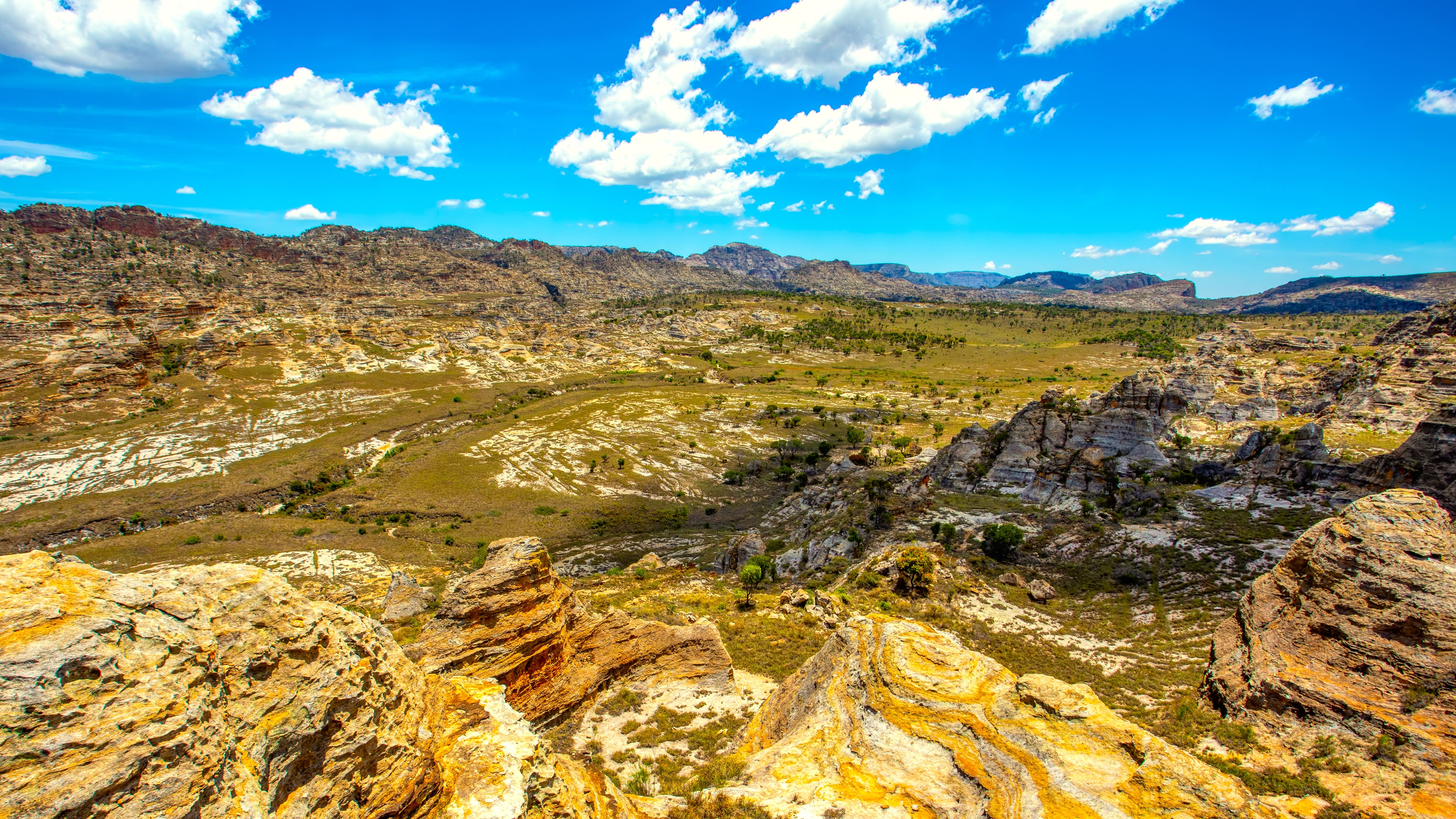
Beyond Ihosy, the landscape shifts. You enter the Horombe plateau, a vast steppe dominated by Bara zebu herding, a people of pastoralists for whom cattle rustling (dahalo) remains a codified social institution. Isalo National Park, around Ranohira, spreads 81,540 hectares of Jurassic sandstone eroded into canyons, natural pools and rock formations. It is Madagascar's most visited park: our teams organize treks from one to three days here, from the Canyon of the Lemurs to the natural pool, passing through Bara burial sites nestled in the cliffs.
The final stage descends towards Toliara through the mining region of Ilakaka, where sapphire transformed a village of 40 inhabitants into a boom town of 60,000 people since 1998. The coast, reached after 250 kilometres of dry plains populated with Adansonia za baobabs, marks entry into Vezo country, nomadic fishermen who sail outrigger canoes. Ifaty, Mangily or Anakao offer seaside rest facing the world's third-largest coral reef.
At table, you move from the romazava and ravitoto of the plateaus to grilled fish and tsaramaso (white beans) of the coast. The markets of Fianarantsoa, Ambalavao with its famous Thursday zebu fair, and Tuléar punctuate the itinerary. The RN7 is not a scenic route in the classical sense: it is a human and ecological transect to be read slowly, at an average real speed of 60 km/h.
To discover
Trekking in Andringitra. Three days of walking between 1500 and 2658 metres, camping under the Milky Way and crossing Pic Boby at sunrise. Well-marked trail but strenuous, total elevation gain of 1800 metres.
Ranomafana humid forest. Night walk with headlamp to observe mouse lemurs and Brookesia chameleons, some of which fit in a teaspoon. Golden bamboo lemur visible in the morning.
Isalo canyons. Day trek to the natural pool, swimming beneath pandanus at 35 degrees. Sunset from the Isalo Window, a sandstone arch framing the plateau.
Ambalavao zebu fair. Every Thursday morning, several hundred head of cattle exchanged by Bara herders who walk from the Horombe. Adjacent antemoro paper workshop, made from avoha bark.
Betsileo vineyards of Fianarantsoa. Tasting at the Soavita estate, Chenin and Couderc varieties grown at 1200 metres. Combined visit with the classified upper town and its Fianarantsoa-East Coast railway.
When to go
The most comfortable period extends from April to November, with a peak between May and October. Temperatures in Fianarantsoa then oscillate between 8 degrees at night and 22 degrees during the day, compared to 15 to 32 degrees in Toliara. The rainy season, from December to March, complicates the crossing: Ranomafana can receive over 400 mm in January, trails become slippery and some secondary tracks (particularly Andringitra) are difficult to traverse. Cyclones in January-February rarely affect the interior but can cut the RN7 for 24 to 48 hours.
Watch out for the altitude contrast: in July-August, nights in Andringitra drop to -7 degrees at Pic Boby, while Ifaty remains at 25 degrees at night. Pack fleece and sleeping bag for the Highlands and light clothing for the coast. July and August concentrate European visitors, while November offers a good balance between dry weather and moderate crowds.
Practical advice
Allow a minimum of seven days for a proper descent, ten to twelve days to include a trek in Andringitra or a beach extension to Ifaty. The logical starting point is Antananarivo, where international flights land; return is by domestic flight Toliara-Antananarivo (1h15) to avoid retracing the route in reverse. Our drivers average 250 km per day: the RN7 is asphalt but dotted with potholes, truck convoys and village crossings where you slow considerably.
The RN7 combines naturally with the Highlands at the start of the journey, and with the Far South if you continue from Toliara towards Fort-Dauphin along the coast (track itinerary, 10 additional days, reserved for experienced travellers). Hotel comfort is decent throughout the route, with well-run lodges at Ranomafana, Tsaranoro and Ranohira. This itinerary suits thoughtful travellers curious about human geography, families with children from 8 years old, and hikers who will find two to three days of strenuous walking here. Travellers seeking exclusive beaches will prefer the North and Nosy Be instead.