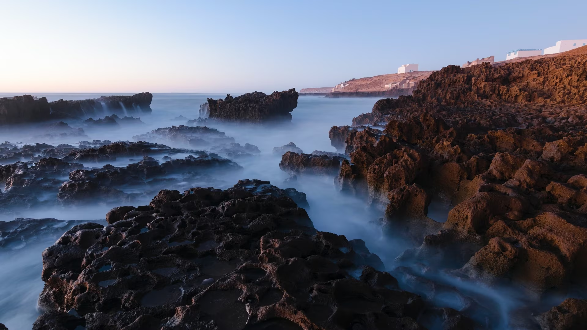
Andringitra: six days of trekking in Betsileo country, from Anja lemurs to Boby Peak
Six days on foot, from Betsileo villages to the granite ridges of Andringitra, with the ascent of Pic Boby and the descent to the Tsaranoro valley.
Duration
9 days
From
€1,000/pers.
Ideal seasons
Apr, May, Jun, Jul, Aug, Sep, Oct
Style
Itinerant travel
Comfort
rustique
Travelers
Solo, With friends, Couple
The spirit of travel
South of the Highlands, Andringitra raises its domes and granite ridges above the Betsileo rice fields. This very ancient massif, worn down by hundreds of millions of years of erosion, culminates at Boby Peak, at 2,658 meters, the second highest summit in Madagascar. To the north, large isolated monoliths dominate cultivated valleys where human activity is everywhere present. To the south, the national park protects a high altitude plateau, slope forests and flora of great richness, with numerous endemic species.
We set out on foot from the Anja village reserve, at the foot of its monoliths, where ring-tailed lemurs live. For two days, we cross Betsileo villages, terraced rice fields and dry hills covered with succulent plants, before entering the national park. We then climb onto the Andriampotsy plateau, around 2,000 meters, from where we make the ascent of Boby Peak. The descent by the western slope crosses a forest of endemic palms and leads us into the Tsaranoro valley, at the foot of its immense cliffs.
Nights are spent under canvas, in bivouacs set up by our team. At altitude, it is cold, especially from June to August, when frosts are frequent: we then reinforce the team of porters to carry the necessary equipment. A cook prepares meals throughout the trek, and a guide accompanies us from first to last day.
For many years, we have been working on this trek with the inhabitants of the region. The porters from Anja accompany us for the first two days, then those from Ambalamanandray take over in the national park until Tsaranoro: the work thus remains in the villages crossed. The Anja reserve is managed by a village association, which dedicates its income to agriculture, health and schooling for families living nearby. On the ground, the team sorts waste into colored bags and brings it back down to the valley; bonuses reward this work, the setting up of camps and help in the kitchen, where assistants are trained over the course of the treks.
Level: medium-level hiking, 4 to 7 hours of walking per day, with a positive elevation gain generally less than 800 meters. On the day of the ascent of Boby Peak, departure is very early and the effort is more sustained. This trek is accessible to anyone in good physical condition, with regular practice of hiking or an endurance sport.
The stages of your journey
Highlights
Day-by-day itinerary

From Antananarivo to Fianarantsoa by the Highlands Road
We leave Antananarivo early in the morning via National Road 7, the great southern route. Throughout the day, we drive across the Highlands, an old base of granite and gneiss worn into rounded hills, covered with red earth, laterite. The valley floors are occupied by rice paddies, often arranged in terraces, and the ridges by villages of brick houses with upper storeys, with wooden balconies.
The road follows the rhythm of the rural world: ox-carts, markets along the roadside, families working in the fields. We pass Ambatolampy, at the foot of the Ankaratra volcanic massif, then Antsirabe, a spa town built in the heart of a region of volcanoes and crater lakes. The soils are fertile, and the roadside stalls overflow with vegetables and fruits according to the season.
Further south, the road becomes more winding. It crosses passes, runs alongside small waterfalls and discovers narrow valleys, developed on every flat spot. We stop at Ambositra, the capital of wood craftsmanship. In the workshops, Zafimaniry and Betsileo artisans carve and marquetry the woods of the Eastern forest, with geometric motifs passed down from generation to generation.
We then enter Betsileo country. The Betsileo are renowned as Madagascar's finest rice farmers: their terraces, maintained for centuries, sometimes climb to the summits of the hills. The family tombs, made of stone, stand in the middle of the crops and remind us of the place of ancestors in everyone's life.
At the end of the day, we arrive in Fianarantsoa, the historical and cultural capital of Betsileo country. The upper town, built on a hill, retains its churches, its paved streets and old houses, with a fine view over the lower town and the rice paddies surrounding it. Fianarantsoa is also a city of schools and universities, very lively during the week.
This first day is long, but it allows you to get a sense of the Highlands and their population, before leaving the road for the trails. We dine and spend the night at the hotel in Fianarantsoa.
Route: approximately 420 km, 9 hours of driving including stops.

Ambalavao and Anja Village Reserve, First Bivouac
We leave Fianarantsoa heading south. The road crosses a patchwork of rice paddies and crops where every shade of green unfolds, then the landscape opens up. The hills become drier, the grass shorter, and the first large granite domes appear on the horizon. We are at the boundary between the Highlands and the south, and the light changes with the terrain.
We arrive at Ambalavao, a small town of wooden-balconied houses, known for its zebu market, one of the largest in the country, and for its antemoro paper, which we will visit on the way back. It is also the gateway to Andringitra: this is where we meet the team that will accompany us during the trek, the cook, the guide and the porters from Anja.
A few kilometres further on, the Anja village reserve nestles at the foot of three enormous granite monoliths. Between the collapsed blocks, a dry forest shelters colonies of ring-tailed lemurs, these primates with ringed tails that have become the emblem of Madagascar. They spend much time on the ground, warming themselves in the sun on the rocks and are easily observed.
With a village guide, we follow a path that winds between the rocks and caves. The trail climbs to a viewpoint over the rice paddies of the valley and the massifs that await us. In the crevices, we also discover chameleons and, depending on the season, flowering plants clinging to the granite.
Anja is a fine example of what well-managed tourism can bring. The reserve was created by the inhabitants themselves and is managed by their association, Anja Miray. Entrance fees finance projects to improve agricultural yields, support crafts, health and schooling for families living nearby. The forest, once threatened, is now protected by those who live from it.
In late afternoon, we set up our camp at the edge of the forest, at the foot of the monoliths. The first dinner under the stars is an opportunity to get to know the team and prepare for the days ahead of walking.
Road: approximately 70 km, 2 hours 30 minutes. Walk: 2 to 3 hours in the reserve.
From Anja to Manampotsy, through Betsileo villages
Anjà → Manampotsy
We leave Anja in the cool of the morning. The trail first crosses the rice paddies of the valley, along the dikes that separate the plots, then climbs gently towards the hills. Around us, large granite domes with smooth sides, streaked by water flow, rise above the crops. They change color throughout the day, from light gray to pink, then ochre in late afternoon.
This first day of hiking is an immersion in the life of Betsileo countryside. We pass from hamlet to hamlet, between red earth houses with thatched roofs, rice granaries and small gardens of cassava, sweet potatoes and corn. The trails are those of the inhabitants and herds: we meet cattle herders leading their zebu towards pastures, women carrying water or rice on their heads, curious children watching hikers pass by.
In these villages, the zebu is at the center of social life. It is used for rice paddy work, particularly for trampling that prepares the plots before transplanting, but it is also a wealth and a link with ancestors, sacrificed during major ceremonies. Our guide explains these customs as we walk, and encounters happen naturally, at our own pace.
At noon, we have a picnic in the shade of a rock or mango tree. In the afternoon, the terrain becomes more pronounced, and the trail gains altitude. Views open up onto the Anja valley, which we leave behind, and towards the higher reliefs of the Andringitra massif, to the south.
We pass through the village of pastors of Manampotsy, then set up our camp on a nearby hill. Porters from Anja pitch the tents while the cook prepares dinner. With nightfall, the cold drops quickly: at this altitude, it is time to bring out warm clothes.
At the camp, nothing is left behind. The team sorts waste into bags of different colors, according to their nature, and carries them back down to the valley. This is a rule on all our treks.
Hiking: approximately 6 to 7 hours.

From Manampotsy to Belambo, entrance to the national park
To Belambo
The landscape changes again. Today we walk in the heart of a setting dominated by large granite massifs, on drier and rockier slopes. Granite slabs outcrop everywhere, polished by erosion, and the trail crosses them in switchbacks. In the hollows, small forests remain clinging to the bottom of valleys, where water is maintained year-round.
On slopes exposed to the sun, we discover vegetation adapted to dryness: aloes, kalanchoes with fleshy leaves, and pachypodiums, these small trees with swollen trunks that store water and grow directly on rock. Many of these plants live only in Madagascar, and some only in this region. The guide teaches us to recognize them, with the names and uses that the local inhabitants give them.
As the day progresses, the highest peaks of Andringitra appear in the distance. Their ridges stand out against the sky and give us a sense of what awaits us in the coming days. We cross a few more isolated hamlets, the last villages before the park, where crops become scarcer.
At the end of the day, we arrive at Belambo camp. We are now in Andringitra National Park, created in 1999 to protect one of Madagascar's richest massifs. It extends from humid forest, on the eastern slope, to the grasslands and rocks of the high plateaus. Inventories have recorded more than a thousand plant species there, including many endemic species.
This is where the porters from Anja leave us. They cannot enter the park and return to their village after two days spent with us. The porters from Ambalamanandray, the village located at the park entrance, take over until the end of the trek. This handover is a local rule that we respect: it shares the work among the region's villages.
In the evening, around the camp, the new team settles in and sets up the tents. Depending on the season, we receive additional porters to carry the warm equipment for high altitude nights.
Hiking: approximately 5 to 6 hours, on sometimes rocky trails.
From Belambo to the Andriampotsy plateau, around 2,000 meters
Belambo → Andriampotsy
We set off early in the morning and climb towards the high plateaus of the park. The trail leaves the wooded valleys behind and opens onto vast expanses covered with grasslands, heather and small shrubs. Granite is everywhere: in domes, in slabs, in chaotic piles of boulders. The higher we climb, the more the landscape becomes mineral and strange.
Around 2,000 meters, we reach the Andriampotsy plateau. The forms sculpted by erosion are so curious that the locals have nicknamed the place the "alien plateau". The rocks take on the appearance of silhouettes, mushrooms or towers. Between them, small streams wind through peatlands, where terrestrial orchids and plants unique to high mountains grow.
Along the way, we make a detour to the two sacred waterfalls of Riambavy and Riandahy, the "female cascade" and the "male cascade". For the local inhabitants, these places are inhabited by spirits and subject to prohibitions, the fady, which our guide explains to us and which we respect. We also pass through Jajofo cave, another place steeped in history, where locals sometimes leave offerings.
The climate changes with altitude. Days often remain sunny and mild, but nights are cold, and from June to August, frosts are frequent on the plateau. In the morning, the grass is sometimes white with frost. We are then grateful to have well-pitched tents, warm sleeping bags and the hot tea that the cook serves from the moment we wake up.
We set up our camp at Andriampotsy, at around 2,050 meters altitude. This is our base camp for the ascent of Pic Boby tomorrow morning. In the evening, if the sky is clear, the starry vault is of rare intensity, far from any light.
This day is also an opportunity to observe the work of the entire team. Pitching tents, setting up the kitchen, sorting waste and preparing meals are all done in a well-established order. Bonuses reward this work, and kitchen assistants learn as they go on treks.
Hiking: approximately 6 to 7 hours.

Ascent of Boby Peak (Imarivolanitra, 2,658 m)
Andriampotsy → Pic Boby
The alarm goes off before dawn. In the light of our headlamps, we leave Andriampotsy camp for the ascent of Pic Boby, which Malagasy people call Imarivolanitra, "close to the sky". At 2,658 metres, it is Madagascar's second highest peak.
The path, well-marked, first climbs onto the plateau, then ascends the granite slopes through a series of switchbacks. The air is crisp, often freezing before sunrise, and we climb at our own pace, taking breaks to catch our breath. Gradually, the sky brightens in the east and the ridges of Andringitra emerge from the shadows.
From the summit, the panorama encompasses the entire massif. To the west, the plateaus descend in steps towards the bara region. To the east, the mountain plunges towards humid forests and, when the sky is clear enough, we glimpse in the distance the East Coast and the Indian Ocean. The first rays of sun light up the granite, and the valleys remain shrouded in mist.
From the summit, the geology reads like an open book: this massif is very ancient. The granites of Andringitra formed deep underground more than 500 million years ago, then were slowly exposed by erosion. The domes, slabs and needles we see from the summit are the result of this long work of water, wind and temperature variations, which fissure and round the rock.
We take time to enjoy it, to photograph and to share hot tea prepared by the team, then we descend by the same path back to Andriampotsy camp. The descent is an opportunity to see, in full daylight, the landscapes we crossed during the night, and to observe high-altitude vegetation: tree heaths, immortelles and cushion plants, adapted to cold and wind.
The afternoon is free at camp. We deserve some rest after the climb: a nap, reading, a walk around the campsite or conversations with the team. We spend a second night at Andriampotsy, before resuming our journey tomorrow towards the western slopes of the massif.
Walking: approximately 5 to 6 hours round trip, including 600 metres of positive elevation gain.
From Andriampotsy to Iantaranomby, through the palm forest
To Iantaranomby
We leave the Andriampotsy plateau to descend towards the western slope of the park. One last time, we cross the lunar expanses of granite and grasslands, where the rocks take increasingly fantastical forms. The trail then follows the ridge lines before plunging into more sheltered valleys, where the air gradually warms up.
The landscape changes as we lose altitude. The streams converge, the banks are covered with shrubs, and the vegetation becomes denser. The western slope of Andringitra is drier than the eastern slope, but the valleys retain enough water to shelter small forests and discreet wildlife. With a bit of luck, we can encounter ring-tailed lemurs here, which live here at surprisingly high altitudes for this species.
Further down, we enter a forest of Ravenea glauca palms, a species that grows only in this region of Madagascar. Their slender trunks, sometimes ten meters tall, and their bluish-green fronds create an unexpected setting amid the granite. These populations are fragile, and their protection is one of the reasons for the park's existence. Our local guide explains to us how these palms resist fire and drought.
In the afternoon, we arrive at Iantaranomby camp, set on the edge of a beautiful river. After several days at altitude, it's time to refresh ourselves in the clear water, do some laundry and enjoy the relative mildness of the valley. The nights here are less cold than on the plateau.
This is our last evening of camping. Around the fire, the team sometimes shares songs and stories from the region. It's a privileged moment to thank the porters, the cook and the guide, who have accompanied us since the beginning of the trek. The campsite is arranged with care: sorted waste is taken away, and the place is left as we found it.
This day, shorter and easier, also allows us to recover before the final stage, which will take us tomorrow to the Tsaranoro valley.
Walking: approximately 4 to 5 hours, essentially downhill.

Tsaranoro Valley, then Ambalavao and Fianarantsoa
Our final walk takes us to the heart of the Tsaranoro valley. The trail descends between granite blocks and fields, and villages reappear. Before us stands the Tsaranoro, an immense rock whose western face, several hundred meters high, is one of the largest rock walls in Madagascar, highly prized by climbers from around the world.
The valley is one of the most beautiful places on the island. Rice paddies, crops and villages with red earth houses spread at the foot of the cliffs, and remnants of preserved forest still shelter ring-tailed lemurs. The inhabitants live from agriculture and livestock farming, and some of them now work with walkers and climbers, as guides or porters. The simplicity and warmth of their welcome give the place a special atmosphere.
We arrive late morning, beneath the great cliffs that accompanied our descent. After lunch, we say goodbye to the porters from Ambalamanandray and the local park guide. Our vehicle awaits us to resume the road to Ambalavao, along a track crossing vast hillside landscapes.
In Ambalavao, we visit an antemoro paper workshop. This technique, of Arab origin, was passed down by the Antemoro, a people from the south-east coast, who used it to write their sacred texts. The paper is made from the bark of a shrub, the avoha. The fibers are boiled, beaten, then spread on cloth frames, where craftsmen inlay dried flowers and leaves by hand. It is a living craft that supports many families in the town.
We then resume the road to Fianarantsoa, climbing back towards the Highlands. Terraced rice paddies reappear, and the landscape becomes gentler. Late in the afternoon, we return to the Fianarantsoa hotel, a hot shower and a real bed after six nights under canvas.
In the evening, we dine together in Fianarantsoa. It is an opportunity to reflect on the six days of trekking, the summits crossed and the encounters made along the way, before the long journey home.
Walking: approximately 3 hours. Driving: approximately 110 km, 3 hours.

Return to Antananarivo via Antsirabe
We leave Fianarantsoa in the morning to head back towards the capital via national route 7. The road crosses the Highlands again, this time in the opposite direction, and the morning light gives a different face to the landscapes discovered on the first day. Terraced rice fields, brick villages and roadside markets succeed one another along the kilometres.
We rediscover the winding valleys of the Betsileo country, then the more open plateaus of Vakinankaratra. The crops change with altitude and seasons: rice in the valley bottoms, corn, beans and potatoes on the slopes, orchards of peach and plum trees around the villages. Along the road, stalls offer products of the season.
In Antsirabe, we stop at a miniatures workshop. The craftsmen reproduce, using recycled materials, vehicles, bicycles and rickshaws with astonishing precision. These rickshaws, or "posy", are moreover one of the symbols of Antsirabe, where they remain a common means of transport. The city, founded at the end of the 19th century around its thermal springs, retains beautiful avenues and buildings from the colonial era.
After the visit, we resume our journey northwards. Lunch, at your leisure, is taken en route. We pass Ambatolampy and the pine forests of Ankaratra, then the road descends towards the Antananarivo plain, with its rice fields and brick factories. We arrive in Antananarivo at the end of the day.
This marks the end of our journey. Depending on the time of international flights, we head to the hotel or Ivato airport. Lunch and dinner on this last day remain free, to allow everyone to organize the end of their stay, a final stroll through the capital or a farewell meal.
We hope that these six days of trekking in Andringitra will leave each of you with memories of vast granite landscapes, starry nights at altitude and the encounters made along the way, with the inhabitants of the villages and with the entire team that accompanied us, from the first to the last step.
Route: approximately 410 km, 9 hours of driving including stops.
Price per person
Indicative price per person, based on double room. Each trip is customized according to your preferences.
This trip can be tailored to your preferences
This itinerary provides an excellent foundation for discovery, but it can be fully customized. Our local advisors build each trip tailored to your budget, dates and preferences.
Not included
- International flights,
- The single supplement, individual room and tent (190 EUR per person),
- J1 lunch and J9 lunch and dinner,
- Beverages, tips and personal expenses,
- Insurance (cancellation, repatriation, loss or damage to baggage),
- The visa fees.
Included
- The services of a guide throughout the trip,
- Round-trip transfers in vehicle (car, minibus or bus depending on group size), fuel included,
- Accommodation in a double or twin room in Fianarantsoa (or similar depending on availability),
- Nights under canvas during the trek, camping equipment provided (bring a warm sleeping bag),
- Full board, except lunch on D1 and lunch and dinner on D9,
- Picnics on walking days and certain transfer stages,
- The trekking team: cook, porters from Anja then park porters, additional porters in cold weather,
- The entrance fees for Anja Reserve and Andringitra National Park, including mandatory local guides,
- The visits scheduled in the program (Antemoro paper at Ambalavao, workshop at Antsirabe).
Practical Information
Registration is considered firm and final after payment of a deposit of 40% of the total price and acceptance of the specific terms of sale.
The balance must be paid no later than 45 days before the departure date.
See our specific terms of sale for full details.
In the event of cancellation by the traveller, the following fees apply:
More than 60 days before departure: 40% of the total price (deposit retained)
Between 60 and 30 days before departure: 50% of the total price
Less than 30 days before departure: 100% of the total price
We strongly recommend taking out cancellation insurance. See our specific terms of sale for full details.
Your Passport:
Important: your passport must be valid. It must be absolutely and obligatorily valid for 6 months after the end of your stay in Madagascar.
Your travel documents
Your valid passport,
Your international and/or domestic flight tickets,
Your repatriation and emergency care insurance contract,
Your vaccination record if applicable,
Your blood type card if possible.
Obtaining a visa to enter Madagascar
Upon arrival in the territory:
Since February 16, 2026, the visa costs €30 for up to 15 days, €35 for 16 to 30 days, €40 for 31 to 60 days and €50 for 61 to 90 days. It can also be requested online before departure on the official e-visa portal (evisamada.gov.mg). An additional tourist tax of €10 is paid in cash upon arrival.
It is easily obtained upon your arrival in Madagascar.
This applies to all airports in Madagascar that handle international flights.
Upon arrival at the airport terminal, upon exiting the plane, a corridor for passengers is dedicated to issuing tourist visas.
This procedure is the simplest. We recommend it to you.
At the embassies and consulates of your home countries:
For information, download the document explaining the procedure and the file requirements for obtaining a visa from the Embassy of Madagascar.
To participate in our trips, it is strongly recommended to be insured for repatriation assistance and medical expenses abroad.
Your local agency encourages you to familiarize yourself with the specific contract developed with our partner CHAPKA ASSURANCES and AXA ASSISTANCE.
To subscribe to insurance, learn about coverage and rates, follow the link below.
CAP EXPLORER: The comprehensive insurance solution designed to enjoy your trip with peace of mind!
Choose the plan that best suits you:
Explorer'Multirisque
Explorer'Annulation
Explorer'Assistance
Specific to our trips, we strongly recommend subscribing to them.
If you choose to subscribe to one of these plans, the policy detailing all coverage and procedures for claiming any loss are available on the insurer's website.
Your local agency will be aware of it, but only the participant is responsible for complying with the procedures for declaring any loss. The participant must therefore keep this policy with them throughout their trip.
Chapka — Cap Explorer
Our insurance partnerTravel with peace of mind with our partner Chapka. Cancellation, repatriation, medical expenses, baggage… All the coverage for a worry-free trip.
Travel with peace of mind — I'll handle the insuranceFrequently asked questions
A tourist visa is required, issued upon arrival at Ivato Airport (Antananarivo) or online (e-visa). Your passport must be valid for at least 6 months from your date of entry. Before booking your trip, check with Madagascar's consular authorities for the conditions applicable to your nationality, including visa fees and authorized lengths of stay.
Go to the My Trips section to find all your projects.
You can send a message to your host directly from the Tea Lounge.
For a tailor-made quality trip, expect between 160 and 270 euros per day and per person, including accommodation, meals, internal transfers and English-speaking guide. International flights (900-1400 euros return) are additional. Long transfers and domestic flights represent a significant portion of the budget.
Your documents are accessible in the Documents tab of your trip.
Absolutely. We adapt each itinerary to suit your travel profile. For families, we prioritize relaxed pacing, family-friendly accommodations, fun and educational activities, and comfortable private transfers. Our local English-speaking guides know how to captivate children with age-appropriate anecdotes.
It's simple. You exchange with our local team to define your wishes, budget and dates. You receive a detailed itinerary proposal within 48 hours. You adjust every detail together until it's perfect. You confirm and travel with peace of mind. Your local agency remains available 7 days a week throughout your trip.
In case of emergency, contact your local agency immediately.
Payment is generally made in two installments.
Our agency is part of the Nomadays network, registered in France. You benefit from APST (Association Professionnelle de Solidarité du Tourisme) protection, which covers 100% of your funds. Secure payment, professional insurance, and English-speaking assistance 7 days a week on the ground throughout your stay. Travel insurance (assistance and repatriation, cancellation) is not included: we offer it through our insurance partner and strongly recommend it.
Let's talk about your adventure — High Plateaus
Ambassador of Malagasy fihavanana, based in Antananarivo
For me, traveling to Madagascar is stepping into the spirit of fihavanana: sharing, helping one another, meeting people, and taking time to understand what connects them to their land.
— Noro