Madagascar in its natural splendor: from the Tsiribihina to the southwestern lagoons, via the Tsingy, baobabs and Highlands
Twenty-seven days to cross Western and Southern Madagascar: three days on the Tsiribihina, the Tsingy de Bemaraha, the Avenue of the Baobabs, the wild coast of the Vezo, then Isalo and the Highlands.
Duration
27 days
From
€2,670/pers.
The spirit of travel
This trip is a large loop through the West and South of Madagascar, for those who have time and the desire to travel on rough tracks. In twenty-seven days, it descends a river, crosses the Tsingy, follows a still wild coast, then climbs back through Isalo and the Highlands.
After Antsirabe and the villages of Betafo, we reach Miandrivazo, where the descent of the Tsiribihina begins. For three days, a motorized barge carries us along the river, between gorges, dry forest and fishing villages, with two nights camping on the riverbanks. Then come three nights in Bekopaka, at the foot of the Tsingy of Bemaraha, for the Manambolo gorges, the Small and then the Grand Tsingy.
The track then leads us to Morondava via the Avenue of the Baobabs, at sunset. Then begins the wildest part of the journey: the South-West coast, which we follow by track, from Belo-sur-Mer to Morombe, Andavadoaka and Salary. Here live the Vezo, nomadic fishermen of the sea. We spend eight nights there in total, staying several days in the same place, because that is the time it takes to grasp its rhythm.
After the thorn forest of Ifaty, we climb towards Isalo and its canyons, then towards the Highlands: Fianarantsoa and its old town, the Upper-Matsiatra by pirogue, the tea plantations of Sahambavy, the forest of Ranomafana and a Tanala village, before returning to Antananarivo via Antsirabe.
This trip is tailor-made, at the date of your choice. We travel in 4x4, with a driver-guide, and a crew accompanies us on the Tsiribihina. In the parks and reserves, local guides accompany us. Accommodations are simple and comfortable, with two nights camping on the river and small hotels on the coast of the South-West. Some track stages are long, particularly between Bekopaka and Morondava, and between Belo-sur-Mer and Morombe: they are part of the journey.
Détours Madagascar is committed to the Travelife certification approach. On this trip, this translates concretely: we call upon river crews, local guides from parks and reserves and villages that welcome us; we observe wildlife without feeding or touching it; and we prefer long stays in one place, especially on the coast, to a succession of stages, for less driving and more time spent on site.
The stages of your journey
Highlights
Day-by-day itinerary
Arrival in Antananarivo
Paris Roissy Cdg → Antananarivo
Upon our arrival at Ivato international airport, a member of the Détours Madagascar team welcomes us and takes us to our hotel, in town.
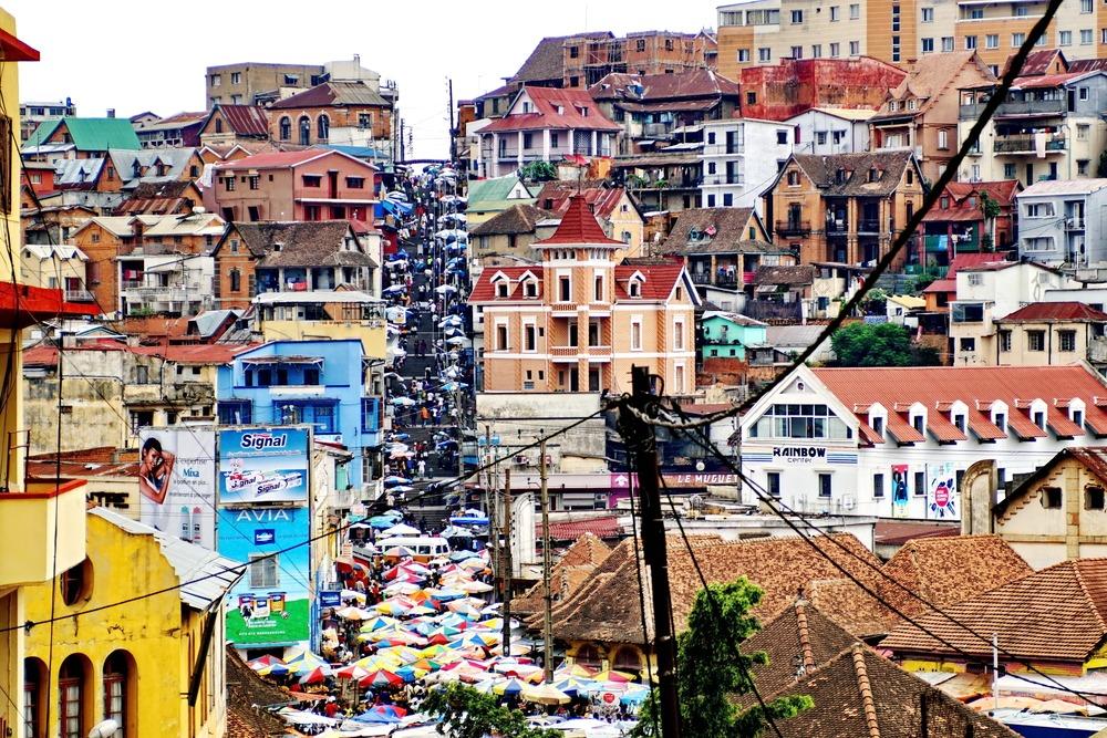
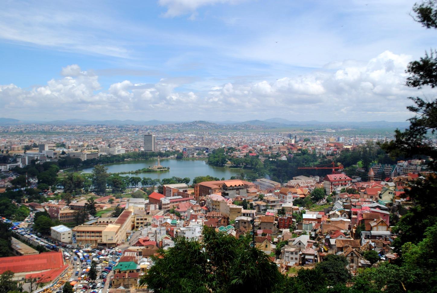
Antananarivo is built on about a dozen hills, amid the rice paddies of the Betsimitatatra plain. Brick houses with stories, with wooden balconies, huddle on the slopes, and long staircases connect the upper neighborhoods to the markets of the lower town. The city was born in the 17th century on the highest of these hills, around the palace of the Merina sovereigns.
If our flight arrives in the afternoon, we have time for a first walk: Independence Square, the busy Analakely avenue, or a viewpoint from which the view opens onto the whole city at sunset. Life takes place largely in the street, between street vendors, minibuses and rickshaws, in a joyful disorder that sets the tone for the journey.
If our flight arrives in the evening, as is often the case, we go directly to the hotel to rest.
The next morning, our team answers our questions about the progress of this long journey. We meet our driver-guide, who will accompany us for almost the entire tour. Dinner is free.
Airport transfer: approximately 45 minutes.
Towards Antsirabe and the villages of Betafo
Early in the morning, we leave Antananarivo via National Route 7, heading south. The road crosses the Highlands: a mosaic of terraced rice paddies, manioc and corn fields, hills crowned with villages of red brick houses. We make a few stops along the way, depending on markets and landscapes, meeting peasants from the roadside.
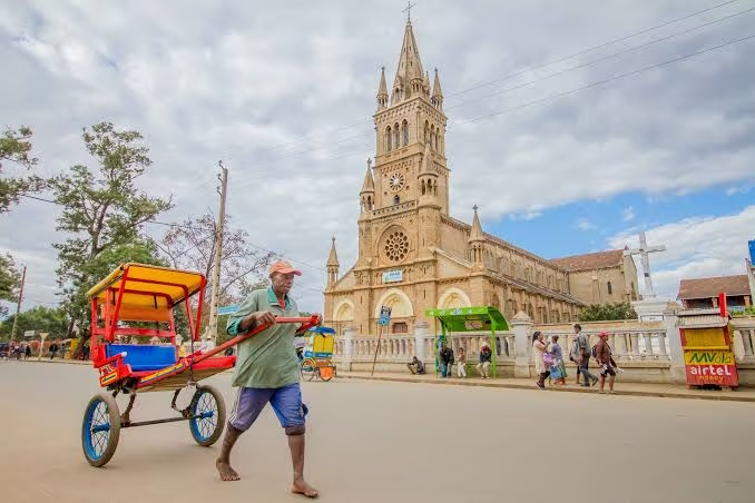
We arrive in Antsirabe late in the morning. A spa town founded in the late 19th century around its thermal springs, it is surrounded by volcanic massifs and retains the air of a mountain resort, with its avenues lined with jacarandas.
In the afternoon, we head west to Betafo. On foot, we travel through a valley dominated by ancient volcanic slopes, where the rice paddies display all shades of green and yellow. We go from village to village, between red brick houses with thatched roofs, tombs and rice paddies. Betafo was the cradle of the ancient kingdom of Andratsay, and the town retains many testimonies to this.
Depending on the weather, we climb up to Lake Tritriva, a crater lake with dark waters, at the bottom of a cirque of volcanic cliffs, surrounded by legends.
Return to Antsirabe at the end of the day. Night in Antsirabe.
Road: approximately 4 hours, 170 km. Antsirabe to Betafo: approximately 30 minutes.
From Betafo
Towards the West and Miandrivazo
After breakfast, we head west towards Miandrivazo. It's a day of driving, and a day of transition: we leave the Highlands for western Madagascar, and the landscape changes hour by hour.
At first, the road still crosses terraced rice paddies, crops and hills with red brick houses of Vakinankaratra. We stop at village markets, where vegetables, poultry and farm products are sold. Then the altitude drops, the air becomes drier and warmer, and the green hills give way to vast savanna spaces, to bare mountains ravaged by erosion in the south of the Bongolava massif. We enter Sakalava country.
Zebus become more numerous, led by herders along the road. Villages become more spaced out, and the first mango and tamarind trees announce the plains of the West.
We arrive in Miandrivazo in mid-afternoon. The small town, situated on the banks of the Tsiribihina, has a reputation for being one of the hottest in Madagascar. This is where we prepare for the river descent that begins tomorrow: our driver-guide checks with us what belongings to take for three days on the water, and what can stay in the vehicle.
Night in Miandrivazo.
Driving: approximately 5 hours 30 minutes, 220 km.
The Tsiribihina, first day of descent
Miandrivazo → Fleuve Tsiribihina
Early in the morning, we join the Masiakampy landing, where a chaland awaits us, a flat-bottomed motorized boat, with its crew and cook. Our driver-guide leaves us here: he departs with the vehicle by road and will meet us again in two days, at the Belo-sur-Tsiribihina landing.
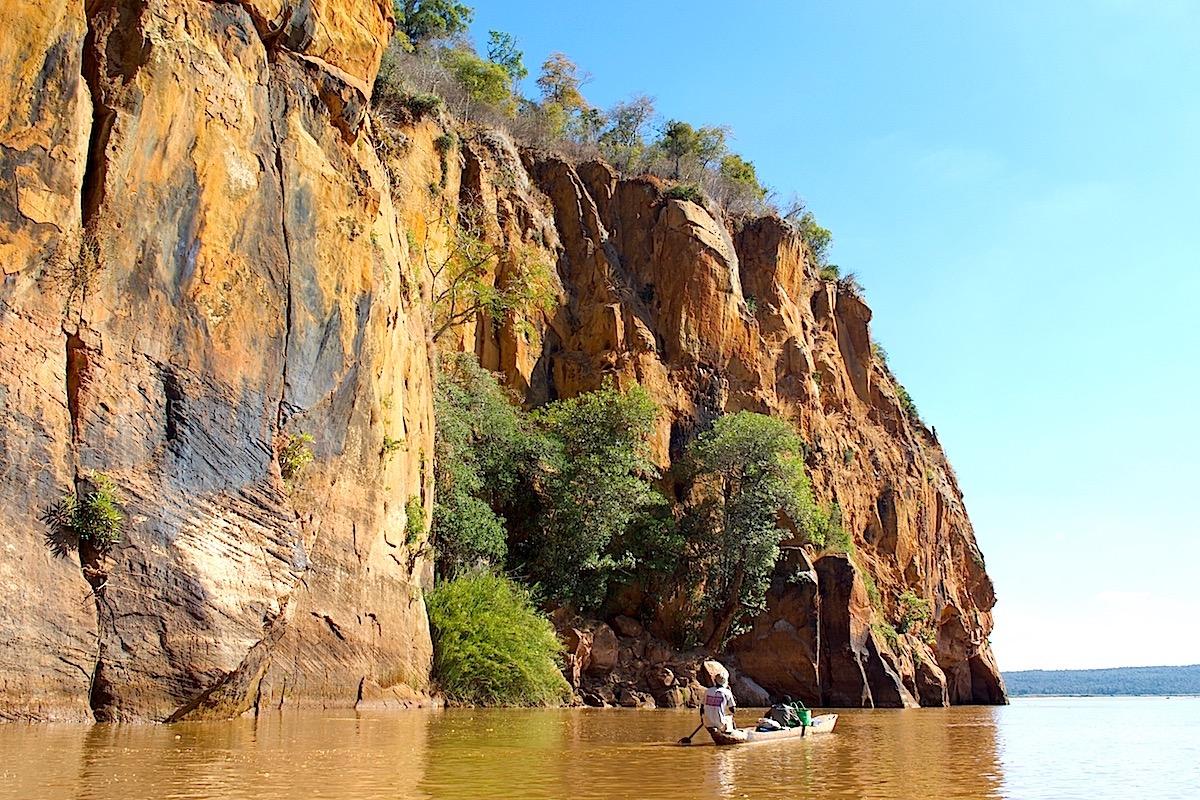
Then begins the descent of the river. For three days, the Tsiribihina carries us westward, through gorges, then plains of savanna and dry forest. The river is wide, ochre in color, and carries the red earth from the Highlands. On the banks, villages of fishermen and farmers live to its rhythm, and children run along the water waving at the boat.
Wildlife reveals itself gradually: herons, kingfishers and other water birds, sometimes lemurs in the trees along the banks, and, with a bit of luck, a crocodile stretched out in the sun on a sandbank. We observe it from afar, without trying to approach it.
We make stops to walk, bathe in a waterfall or visit a village. Meals are prepared on board by the cook.
In late afternoon, well before nightfall, the crew sets up camp on a sandy bank. Dinner is taken by the river, under a remarkably clear sky. First night under canvas.
Drive to the landing: approximately 1 h, 25 km. Navigation: approximately 5 h, with stops.
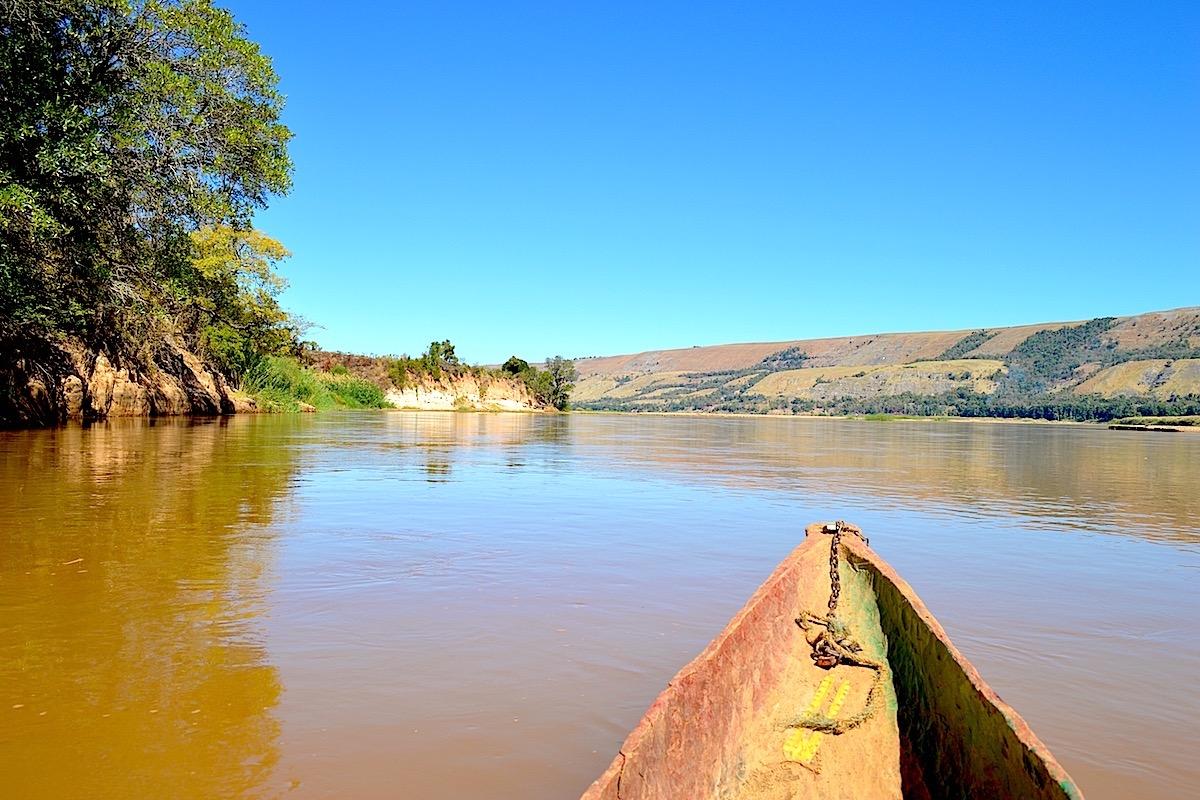
The Tsiribihina, waterfalls and villages
We wake up on the riverbank, with the first sounds of the day. After breakfast, the crew strikes the camp and we resume sailing.
The morning takes us to the Nosy Ampela waterfall. Its clear water falls into a natural pool, and it's the opportunity for a welcome swim and a bit of washing up, before heading off again.
Navigation then resumes for about two hours until we reach the village of Begidro, known for its lemurs. We walk to the village and into the nearby forest, where lemurs are often seen in the trees. Like everywhere on this trip, we observe them without feeding or touching them. We have lunch in the village.
In the afternoon, the boat glides slowly downstream. The landscape opens up: dry forests, isolated baobabs, rice fields and pastures where zebu graze. Fishermen's pirogues become more numerous, and we sometimes cross other boats heading down the river laden with goods.
At the end of the day, we arrive at Berevo, where the crew sets up the second camp. In the evening, around dinner, the crew tells stories of life on the river, the floods during the rainy season and the villages that depend on it.
Second night under canvas, on the banks of the Tsiribihina.
Navigation: approximately 5 hours, with stops.

End of the descent and trail to Bekopaka
After breakfast, we continue navigating for a few more hours. Gradually, villages draw closer, the river becomes busier, and the plain widens until Belo-sur-Tsiribihina, where we dock late in the morning. Our driver-guide is waiting for us there with the vehicle.
We have lunch, then take the track northwards, heading towards Bekopaka and the Tsingy de Bemaraha massif. It is an earth track, sometimes bumpy, crossing savanna, rice paddies and forests of baobabs and palm trees. Several stops allow us to stretch our legs and discover Sakalava villages.
The track crosses rivers by fording or by ferry, depending on the season, and the crossing of the Manambolo, at the end of the route, is by ferry. It is often the longest moment of the day, but also one of the most lively.
We arrive in Bekopaka at the end of the day, at the foot of the Tsingy de Bemaraha massif, listed as a UNESCO World Heritage site. The village sits on the banks of the Manambolo, facing the first limestone cliffs.
We settle in for three nights: after three days on the river, a real bed and a shower are welcome. Dinner is taken quietly, after a long day.
Navigation: approximately 3 hours. Track: approximately 4 hours 30, 100 km, including the ferry crossing of the Manambolo.
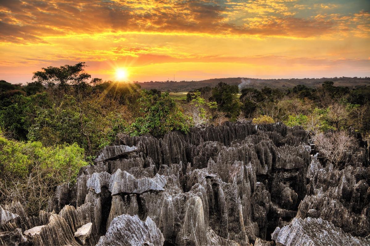
The Manambolo Gorges and the Little Tsingy
The Tsingy are a limestone plateau cut by rainwater into a labyrinth of blades and needles, sometimes tens of meters high. Their name comes from a word that evokes the idea of walking on tiptoes. The Tsingy de Bemaraha national park protects the largest expanse of them in Madagascar.
We start the day with the Manambolo gorges, by canoe. The river has carved the plateau into a narrow canyon with vertical walls. We glide at the foot of the cliffs, where caves open up and plants cling to the rock. A stop allows us to enter one of these caves and see up close the shapes that water has sculpted in the limestone.
Then we set off on foot, with a local guide from the park, into the Petits Tsingy, very close to the village. The trail winds between limestone blocks, passes through narrow fissures and climbs to viewpoints from which the gaze plunges over the forest and stone needles. The dry forest that grows between the Tsingy is home to lemurs, birds and chameleons, which the guide helps us spot.
The afternoon is free to rest by the river or walk through the village. Second night in Bekopaka.
Canoe and walking: approximately 4 to 5 hours during the day.
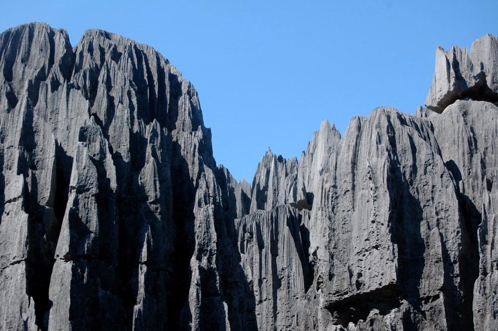
The Grand Tsingy of Bemaraha
We leave early for the Grand Tsingy, the most spectacular part of the park. A 17-kilometer track takes us by 4x4 to the start of the trail, north of Bekopaka.
With a local guide, we enter a mineral world: gigantic limestone cathedrals, networks of deep cracks, blocks sculpted into blades and sharp points. The route alternates between passages through canyons with lush vegetation, climbs via ladders and footbridges, and crossings of limestone slabs covered with dry vegetation. Cables and harnesses secure the most vertiginous passages, and the guide explains how to use them.
After several hours of hiking, we reach the roof of the Tsingy, a viewpoint suspended above a forest of stone that extends to the horizon. It is one of the most stunning landscapes in Madagascar.
The park's wildlife can sometimes be observed along the way: Decken's sifakas, with white fur, leap from rock to rock, and birds nest in the crevices. No sighting is guaranteed, but the guide knows the places where chances are best.
This hike requires good physical fitness and not being afraid of heights. Lunch is taken along the way.
Return to Bekopaka at the end of the day. Third and last night in Bekopaka.
Track: approximately 45 minutes. Hike: approximately 5 to 6 hours.
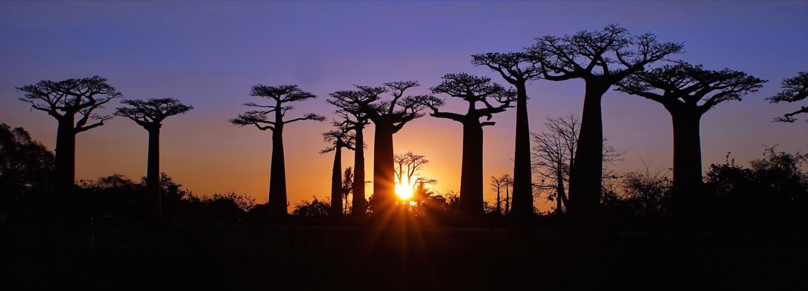
Towards Morondava by the Avenue of the Baobabs
Early in the morning, we leave Bekopaka heading south, by the same track as on the way there. The low morning light gives the cliffs and savanna colors that we had not seen upon arrival.
We cross the Manambolo again by ferry, then the track leads us to Belo-sur-Tsiribihina, where we have lunch. In the afternoon, we cross the Tsiribihina, this time by ferry, and we can see the river we traveled down a few days earlier from a different perspective. It is the ferry crossings, more than the distance, that make this day's journey long.
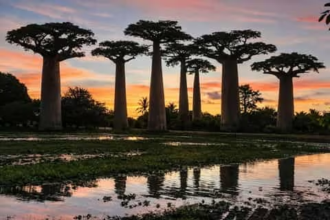
Then the track plunges into a landscape of rice paddies and dry forests, where baobabs become increasingly numerous. Late in the afternoon, we arrive at the Avenue of the Baobabs. About twenty Grandidier baobabs, over twenty meters tall, line the red earth track. Some are several centuries old. It is at sunset, when the orange light silhouettes them against the sky, that the avenue is most beautiful, and we take time to stop there.
Not far away, we can also see the lover baobabs, two trees intertwined around which many legends run.
We arrive in Morondava early in the evening. Night in Morondava.
Track: approximately 9 to 10 hours, 200 km, with two ferry crossings and a stop at the Avenue of the Baobabs.
Towards Belo-sur-Mer, on the wild coast
After breakfast, we leave Morondava heading south, for the wildest part of the journey: the South-West coast.
The track runs along the coastline through savanna countryside, dry forests and mangroves, and crosses a few villages where fish is drying. It passes along the edge of Kirindy Mitea national park, which protects dry forests, mangroves and lakes. Depending on the condition of the track, we sometimes have to cross sandy passages, and our driver-guide knows these roads well.
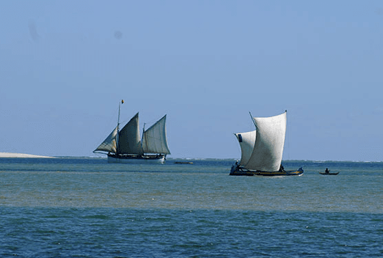
We arrive in Belo-sur-Mer early in the afternoon. This Vezo fishing village sits on the edge of the Mozambique Channel, between a lagoon, a mangrove and white sand beaches. It is known throughout the island for its shipbuilders, who still build large wooden dhows by hand on the beach, using techniques passed down from generation to generation.
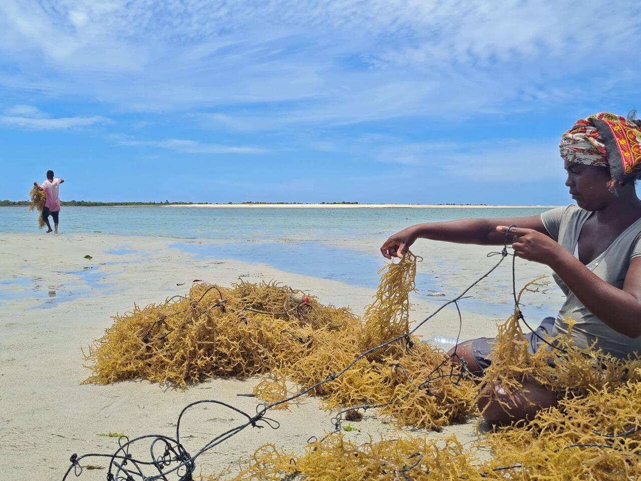
The village lives to the rhythm of the sea: outrigger canoes depart at dawn and return at the end of the day, laden with fish and octopus. Further on, salt marshes extend behind the beach.
We settle in for three nights by the sea, to take time in this timeless village. Night in Belo-sur-Mer.
Track: approximately 3 hours, 100 km.
Belo-sur-Mer, at the Shipwrights
These two days in Belo-sur-Mer are free. They are here to give us time to live at the pace of the coast, after the long stretches of track.
The shipyard is the village's first point of interest. On the beach, carpenters shape the ribs and planking of dhows – large wooden sailing vessels that still transport salt, rice and goods along the coast – using adzes and saws. Some boats take years of work. The carpenters welcome visitors willingly, and they explain their craft with pride.
Vezo fishermen also offer outings in outrigger canoes on the lagoon and towards the offshore islets, where coral reefs can be explored with mask and snorkel. The corals remain fragile: we do not touch them and do not walk on them.
For those who like to walk, the beach stretches for kilometres, and trails lead to salt marshes, neighbouring villages or dry forest and its baobabs. Kirindy Mitea national park is very close by, with its lakes and mangroves.
It is also perfectly fine to simply do nothing: read in the shade, swim, watch the canoes return at sunset.
These activities are not included and are arranged on site. Second and third nights in Belo-sur-Mer.
The long track to Morombe
We are leaving early this morning, as this is the longest track section of the journey. It connects Belo-sur-Mer to Morombe, further south, through one of the most isolated regions of Madagascar.
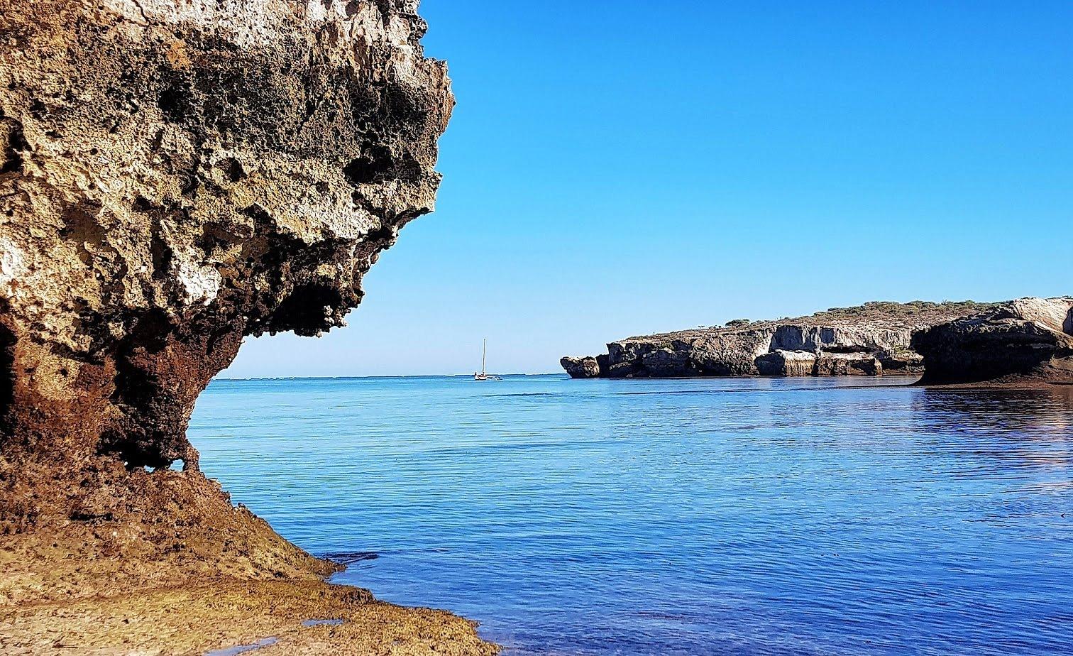
The track moves away from the coast and crosses a landscape of savanna, dry forests and large baobabs, interspersed with rivers to ford depending on the season. Villages are rare, and each stop is an opportunity to meet the inhabitants, cattle herders and farmers, who see few travelers pass through. There are hardly any comfortable stops along the way, which is why we make this journey in a single day.
Our driver-guide knows the difficulties of this track, which vary according to the year's rainfall. He chooses the stops for lunch and to stretch our legs. The day is long, but it gives a sense of the immensity of the Malagasy Southwest.
We arrive in Morombe in the late afternoon, before nightfall. The small coastal town, situated on the edge of the Mozambique Channel, is the gateway to a coastline of lagoons and still wild beaches. The Vezo fishermen pull their pirogues up on the beach, at the foot of a row of coconut trees.
After dinner, a good night's rest is welcome. Night in Morombe.
Track: approximately 9 hours 30 minutes, 200 km.
From Morombe to Andavadoaka, along the lagoon
After a quiet morning, we resume the track heading south. It's a short stage that runs along the coast of the Mozambique Channel, between dunes, mangroves and fishing villages.
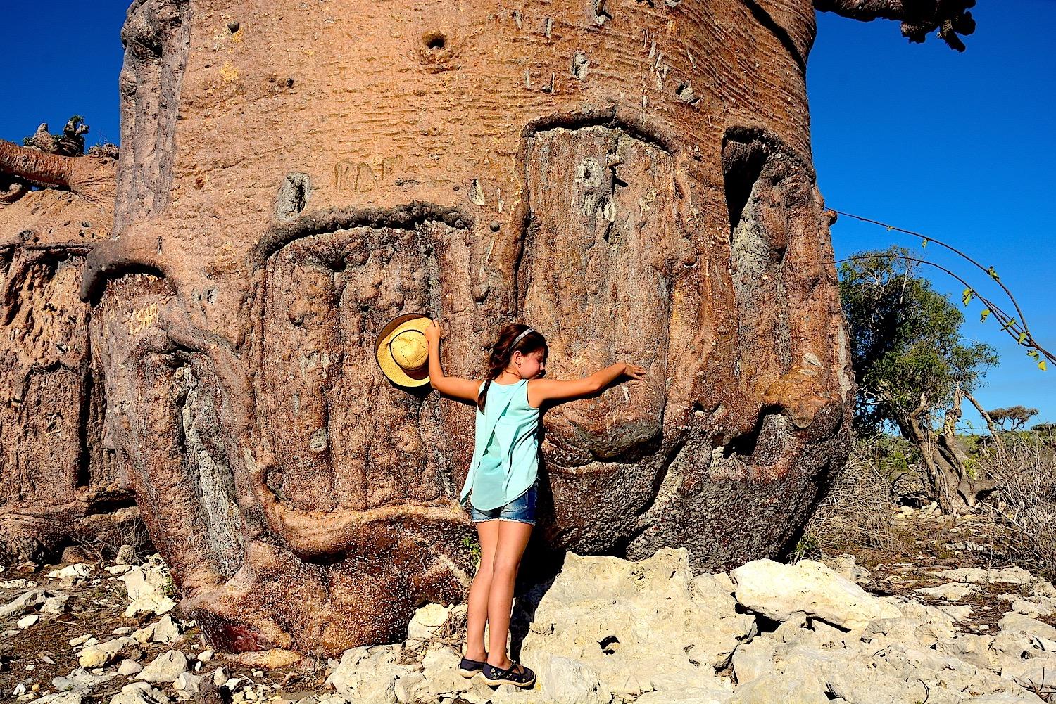
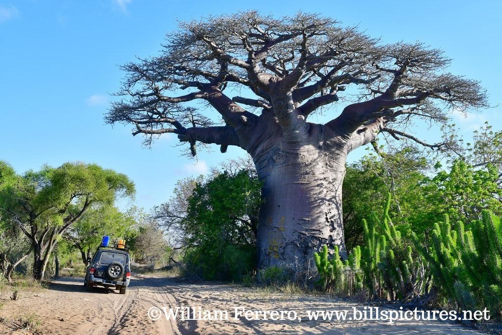
Along the way, we stop to discover the baobab forests that dot the interior lands, not far from the sea and lagoon. Some of these trees, with their massive trunks, are among the most impressive on the island. Lunch is a picnic, in the shade.
We arrive in Andavadoaka early in the afternoon. This Vezo fishing village is located north of Assassins Bay, in a remarkable setting: a bay with turquoise waters, white sand beaches, islets and a coral reef that protects the lagoon.
The Vezo, a seafaring people, live here from fishing, in outrigger canoes. For several years, the villages in this region have been managing part of their fishing zones themselves, with temporary closures that allow octopus and reefs to recover. It is one of the most cited examples of local sea management in Madagascar.
The rest of the day is free to settle in and enjoy the beach. We stay two nights in Andavadoaka.
Track: approximately 1 hour 30 minutes to 2 hours, 75 km.
Free day in Andavadoaka
This day is free to fully enjoy Andavadoaka and its lagoon.
The coral reefs can be discovered just a few meters from the shore. The water is clear, and the reef is home to a multitude of colorful fish, corals and starfish. Snorkeling enthusiasts can spend hours there. For divers, scuba diving excursions are organized depending on conditions. The corals remain fragile: we do not touch them and do not walk on them.
Fishermen also offer traditional outrigger canoe trips on the lagoon and to the islets, and this is an opportunity to see them at work, to understand their fishing techniques and their knowledge of the sea. In the village, women prepare fish and octopus, which dry in the sun on racks.
Inland, a few kilometers away, large baobab forests can be discovered on foot, amid thorny vegetation.
For those who prefer relaxation, the beach and lagoon are more than enough to fill the day. The sunset over the bay, when the outrigger canoes return, is one of the beautiful moments of the stay.
These activities are not included, which leaves everyone free to choose. They are easily organized on site. Second night in Andavadoaka.
From Andavadoaka to Salary, along the coast
After breakfast, we continue south along the coastal track. It runs along the coast, between the sea and the thorny forest, and crosses fishing villages where pirogues are lined up on the sand.
The landscape changes gradually. South of Andavadoaka, Assassins Bay cuts into the coastline in a wide indentation bordered by mangroves. Further on, the thorny forest becomes denser, with its didiereaceae, these spiny plants unique to southern Madagascar, its euphorbias and baobabs. The sandy track sometimes requires slowing down, and our driver-guide adapts the pace.
We make a few stops along the way, to walk on a deserted beach or greet a village. Encounters are simple and warm, and children often run to see the vehicle pass by.
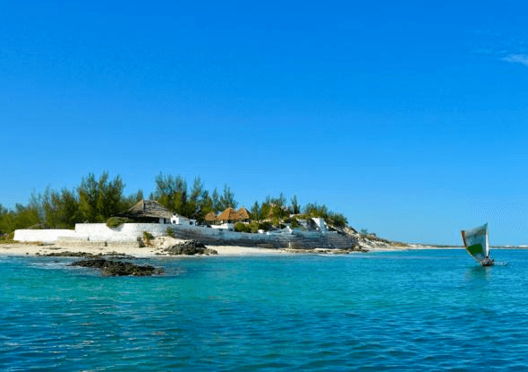
We arrive in Salary in early afternoon. The place is a small preserved spot, set on the edge of a lagoon with crystal-clear waters, protected by a coral barrier, with a long stretch of white sand and a few Vezo fishing villages. The calm is total, far from everything.
The rest of the day is free to settle in and enjoy the lagoon. These are two very different and complementary environments that succeed each other on this coast: after Andavadoaka Bay, the great Salary lagoon. We stay there for two nights.
Track: approximately 3 hours, 95 km.
Free day in Salary
This day is free, to savor the tranquility of Salary and its lagoon.
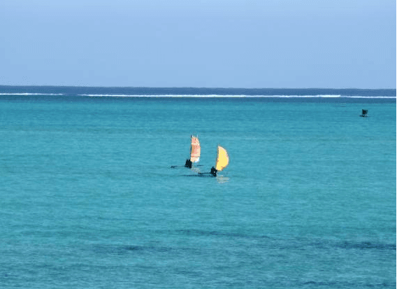
The lagoon, protected by the coral reef barrier, is ideal for swimming and snorkeling. At low tide, it is partially uncovered, and a walk on the reef flat reveals the seagrass beds, shells and small creatures that live there. The corals remain fragile: we do not touch them and do not walk on them.
Vezo fishermen offer outings in outrigger canoes, under sail, towards the coral barrier or along the coast. It is a beautiful way to discover the lagoon, at the pace of the wind, and to better understand the life of these fishermen, who spend most of their days at sea.
For walkers, the beach extends for kilometers, and trails lead into the thorn forest, where birds, chameleons and, sometimes, land tortoises live. The hotel guide or a villager can accompany us.
And this free time can also be used for rest, quite simply. After the long overland stages and nights under canvas, these days by the sea are fully part of the journey.
These activities are not included and are organized on site. Second night in Salary.
Towards Ifaty and the Reniala Spiny Forest
After breakfast, we leave Salary and continue south along the coastal track to Ifaty.
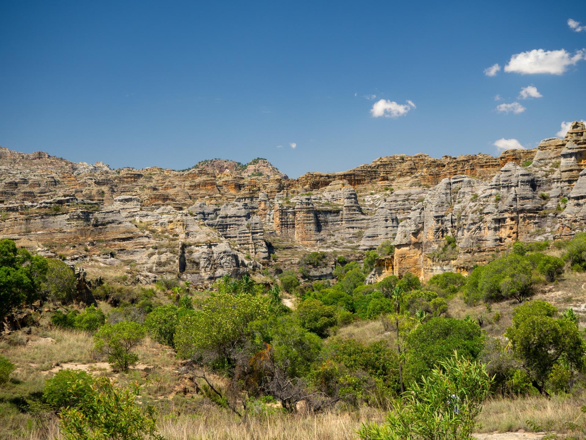
The track crosses a landscape of dunes and thorny forest bordering the Mozambique Channel. We pass Vezo fishing villages where outrigger canoes glide across the lagoon, and traverse expanses of sand where baobabs raise their massive silhouettes. The light is brilliant, and the contrast between the blue sea and the grey-green thorny forest is striking.
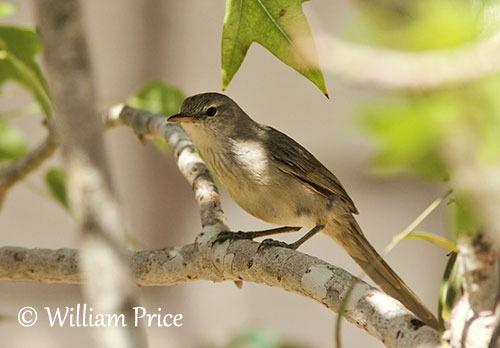
We arrive in Ifaty in early afternoon and set out on foot to visit the Reniala reserve with a local naturalist guide. The reserve protects a section of the thorny forest of southern Madagascar, one of the world's most singular ecosystems, unique to this arid region. The vegetation is remarkable: baobabs with sculptural forms, some of which are several centuries old, didiereaceae with formidable spines, pachypodiums and candelabra-shaped euphorbias.
The guide also shows us the medicinal plants that villagers still use and introduces us to the birds of the forest, some of which live only here. The visit lasts between one and a half and three hours, depending on the trail chosen.
Night in Ifaty, on the edge of the lagoon.
Track: approximately 4 hours, 110 km.
Salary → Ifaty
From Ifaty to Isalo
Today, we leave the coast to head inland. We pass through Tuléar for a stop at the waterfront or to run some errands, then take national road 7 heading northeast.
Gradually, the landscape transforms. The thorny plants of the coast give way to a more open savanna, dotted with large tombs, sometimes decorated with zebu horns and carved poles, which bear witness to ancestor worship in the South. Further on, the road crosses the Ilakaka region, where the discovery of sapphires in the late 1990s gave birth to a town in just a few months.
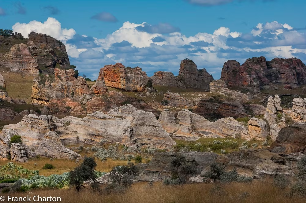
In the late afternoon, the first reliefs of Isalo appear on the horizon: a sandstone massif with ruiniform shapes, carved out by canyons, which ignites in the evening light.
We arrive at Ranohira, the village that serves as the gateway to Isalo National Park. We settle in for two nights, at the foot of the massif, and enjoy the sunset over the cliffs.
This is the land of the Bara, zebu herders, renowned for their pride and attachment to their freedom. The herds are central to their life and traditions.
Road: approximately 6 hours, 340 km.
Ifaty → Ranohira
Les canyons et les piscines naturelles de l'Isalo
We dedicate this day to exploring Isalo National Park on foot with a local guide.
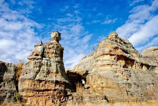
Created in 1962, the park protects a sandstone massif formed some two hundred million years ago, during the Jurassic period. Erosion has sculpted an astonishing landscape of domes, towers, deep canyons and grassy plateaus. The massif extends nearly one hundred kilometers from north to south.
The trail first climbs onto the plateau, where the view opens onto the reliefs and savanna. The guide shows us the vegetation adapted to the rock: aloe, euphorbias and elephant feet, these pachypodiums with swollen trunks that cling to the sandstone. We then cross cooler canyons, where a stream flows between ferns and pandanus plants.
Along the way, a natural pool with clear waters at the foot of a waterfall invites swimming. Lunch is taken in the shade, by the water's edge.
Ring-tailed lemurs, Verreaux's sifakas and brown lemurs can sometimes be observed near the canyons, as well as reptiles and birds. No sighting is guaranteed, and we do not feed the animals.
Return to Ranohira in late afternoon. Second night in Ranohira.
Hiking: approximately 5 to 6 hours.
Towards Fianarantsoa and the Highlands
After breakfast, we take National Road 7 heading north towards the Highlands.
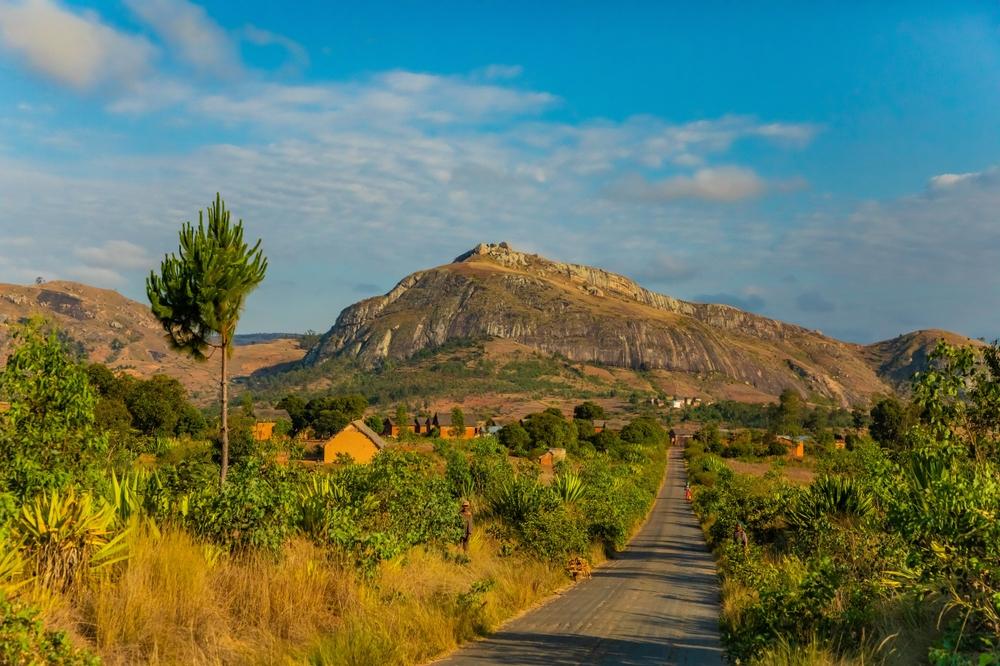
We first cross the Horombe plateau, a vast grassy expanse where herds of zebu cattle graze beneath an expansive sky. Then the landscape becomes more rugged, and the road approaches the granite massifs that herald the Betsileo country. Near Ambalavao, we can stop at the zebu market, one of the largest on the island, or at the workshop where antemoro paper is still made, decorated with dried flowers.
Lunch is taken along the way, at Ambalavao or a little further north. Beyond, terraced rice paddies reclaim the landscape. The Betsileo are renowned for their rice cultivation skills, and their terraces hug the hillsides all the way to the top.
We arrive in Fianarantsoa in mid-afternoon. The city is built on several hills, and its old town, the upper town, preserves a fine ensemble of brick houses with wooden balconies, churches and paved alleyways. Depending on the weather, a walk through the old town allows you to discover this district and its viewpoints over the surrounding area.
Night in Fianarantsoa.
Driving time: approximately 5 hours, 220 km.
Haute-Matsiatra by canoe to Sahambavy
After breakfast, we leave Fianarantsoa for a short journey to the boarding point on the Haute-Matsiatra.
We embark on pirogues, led by boatmen from the riverside villages, for a peaceful descent down the river. It is another way to discover the Highlands, at the pace of the water and in silence. The river winds between rice paddies, hills and granite boulders, and village life unfolds on the banks: women wash clothes, children bathe, farmers work in the rice fields.
The descent lasts a few hours, with stops to walk and meet the locals. Water birds, herons and kingfishers, accompany the pirogues.
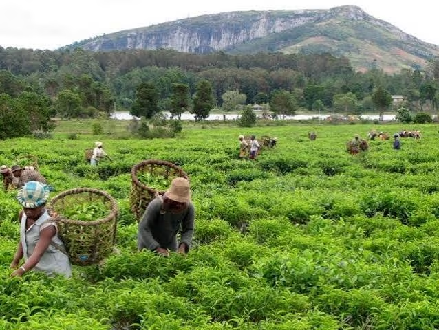
We arrive late morning near Sahambavy, where our driver-guide awaits us. The village is situated on the edge of a lake, in the middle of tea plantations that cover the hills. It is one of the rare regions of Madagascar where tea is cultivated. In the afternoon, we can visit the plantation and factory, to understand the harvesting and production of tea, and taste it.
At the end of the day, the light on the lake and tea plants is one of the beautiful moments of the day. Night in Sahambavy.
Drive to the boarding point: approximately 1 h, 40 km. Pirogue: approximately 3 h.

Towards Ranomafana Forest
After breakfast, we leave Sahambavy to reach Ranomafana, to the east.
The road winds down the foothills of the Highlands towards the great humid forest of the East. Within a few kilometers, the landscape changes completely: rice paddies and hills give way to dense vegetation, tree ferns, and waterfalls cascading alongside the road. The air becomes warmer and more humid.
We arrive in Ranomafana late morning. The village, whose name means "hot waters", is known for its thermal springs. It is situated on the banks of the Namorona river, in the heart of the forest.
The afternoon is free for us to settle in and rest. We can also go swimming at the village's hot springs, in a pool fed by thermal water, or walk along the river.
In the evening, night visits with headlamps are possible, on the edge of the park, with a local guide, to discover chameleons, frogs and small nocturnal lemurs. These outings are not included, and our driver-guide can help us organize them.
We stay two nights in Ranomafana, to take time to explore the forest.
Driving time: approximately 1 hour 30 minutes.
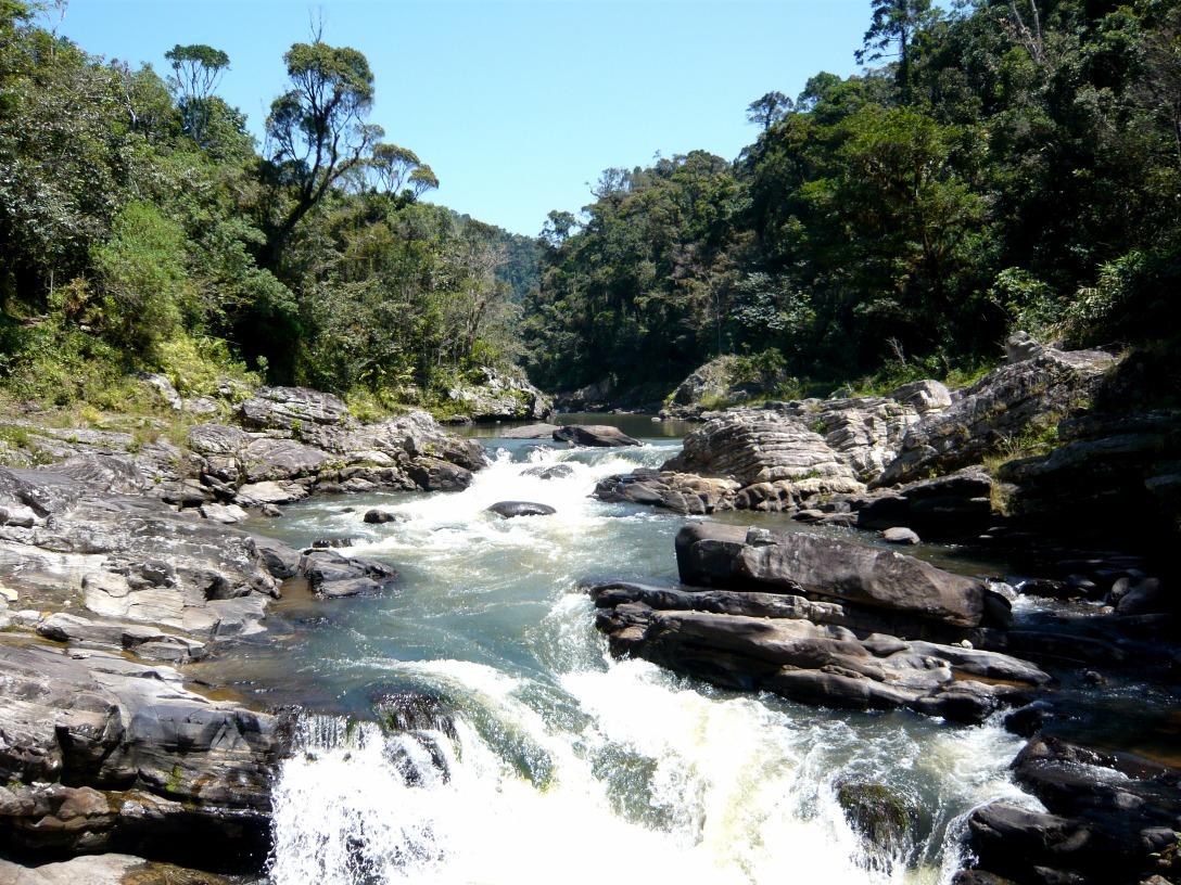
The Ranomafana Forest and a Tanala Village
We leave early in the morning for Ranomafana National Park, with a local guide. The morning is the best time to observe wildlife.
Created in 1991, the park protects more than forty thousand hectares of rainforest, on the slopes of the eastern escarpment. It is part of the Atsinanana rainforests, inscribed in the Unesco World Heritage. It was the discovery of a rare lemur, the golden bamboo lemur, that led to its creation. The park is home to a dozen lemur species, as well as many birds, chameleons, frogs and insects.
The trail goes up and down through dense forest, among tree ferns, orchids and bamboo. The guide spots lemurs in the canopy and explains the life of the forest and medicinal plants. No sighting is guaranteed, but the forest is rich.
In the afternoon, we visit a Tanala village, about fifteen kilometers from Ranomafana. The Tanala, "those of the forest", are a forest people of the Southeast, who remained long independent of the kingdoms of the Highlands. Their culture remains closely linked to the forest, from which they extract bamboo, wild honey, fruits and medicinal plants. The village, with its houses on stilts made of bamboo and earth, is reached by a short walk up the hill.
Second night in Ranomafana.
Walk in the park: approximately 4 hours. Road to the Tanala village: approximately 30 minutes.
Return to Antsirabe via the Highlands
It's a day of driving that takes us up the Highlands heading north. We leave early, after breakfast.
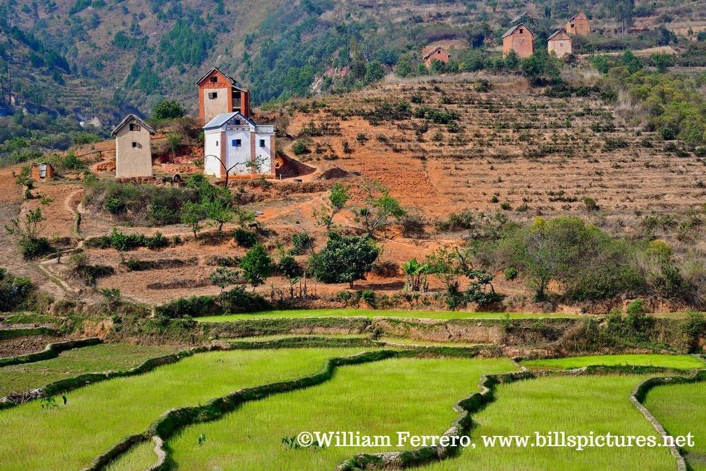
The road leaves the Ranomafana forest and climbs the escarpment to the Highlands, where it meets national road 7 north of Fianarantsoa, without passing through the city. It then crosses Betsileo country, its terraced rice paddies and villages with brick houses.
Along the way, we make a stop in Ambositra, the capital of Malagasy craftsmanship. The Zafimaniry, a people from the nearby forest, have passed down an art of wood sculpture with geometric patterns, inscribed in Unesco's intangible cultural heritage. The city's workshops and shops also showcase marquetry, which is Ambositra's claim to fame. It's an opportunity to see artisans at work.
Lunch is taken on the road, in Ambositra or in a Betsileo village. Then the road continues north, through increasingly cultivated hills, until Antsirabe, where we arrive late in the afternoon.
Upon arrival, we can take a short city tour, or have ourselves driven in a pousse-pousse, Antsirabe's emblematic means of transport, along its avenues lined with jacarandas. The pousse-pousse is not included.
Night in Antsirabe.
Road: approximately 6 hours, 240 km, including the stop in Ambositra.
From Antsirabe to Antananarivo
In the morning, before leaving Antsirabe, we visit the city's craftsmen. Some make miniatures of bicycles, cars and rickshaws from recycled materials with astonishing precision. Others work with zebu horn to create jewelry, cutlery and decorative objects. We see the craftsmanship at work and can take home an object made here.
Then we take National Road 7 heading north. Rice paddies and villages characteristic of the Highlands shape the landscape, with brick houses with upper stories and hills crowned with churches.
Halfway there, we stop in Ambatolampy. This small, bustling town is known for its artisanal foundries, where workers pour recycled aluminum into sand molds to make the pots found in every kitchen on the island. The work is done by hand, and the spectacle of the pouring is impressive.
Lunch is taken on the road. We continue in the afternoon towards Antananarivo, where we arrive at the end of the day. As we approach the capital, traffic becomes denser, and patience is sometimes needed to reach the hotel.
In the evening, it's time to gather your memories after nearly a month of travel. Dinner on your own. Night in Antananarivo.
Road: approximately 4 hours, 170 km.

Last day in Antananarivo, then return flight
This last day is free, for a final discovery of the capital or last-minute shopping. Our vehicle remains at your disposal.
We can head up to the upper city and the Rova, the Queen's Palace, at the top of Analamanga hill, from where the view embraces the entire city. The craft markets along the dike road are also an opportunity to bring back some souvenirs: embroidery, zebu horn objects, woven raffia or sculpted wood. The Analakely district and its covered market are the lively heart of the lower city.
International flights to Europe usually depart in the evening or at night. If the flight is late, it is possible to book a room for a few hours in a hotel near the airport, to rest and freshen up before departure. This room is not included and should be reserved in advance.
In the evening, we are driven to Ivato airport, where a team member accompanies us to the check-in for our international flight.
This marks the end of a long journey that has taken us from the Tsiribihina to the Tsingy, from baobabs to the lagoons of the South-West, then from Isalo to the Highlands. We hope it will leave each of you with memories of nights by the river, vezo pirogues and the hospitality of our hosts. Veloma, goodbye, and see you soon in Madagascar.
Transfer to the airport: approximately 45 minutes.
Antananarivo → Paris Roissy Cdg
Price per person
Indicative price per person, based on double room. Each trip is customized according to your preferences.
This trip can be tailored to your preferences
This itinerary provides an excellent foundation for discovery, but it can be fully customized. Our local advisors build each trip tailored to your budget, dates and preferences.
Not included
- International flights
- Visa fees
- Lunches and dinners not mentioned, and beverages
- Free activities on the coast (pirogue, snorkeling, diving, excursions)
- The city tour by rickshaw in Antsirabe
- The single room supplement
- Insurance assistance, repatriation and cancellation
- Tips and personal expenses
Included
- Airport welcome and transfers in Antananarivo
- The 4x4 with driver-guide, fuel included, throughout the entire circuit
- The descent of the Tsiribihina by motorized barge, with the crew, cook and bivouac equipment
- Accommodation in a double or twin room for 24 nights, and 2 nights camping on the Tsiribihina
- Breakfasts, full board on the Tsiribihina, dinners on the South-West coast and the Isalo picnic
- The entrance fees and local guides for parks and reserves (Tsingy de Bemaraha, Reniala, Isalo, Ranomafana)
- The pirogue in the Manambolo gorges and the descent of the Haute-Matsiatra by pirogue
- The visit of a Tanala village near Ranomafana
- Ferry crossings and tolls along the way
- The assistance of our team in Antananarivo throughout your trip
Practical Information
Registration is considered firm and final after payment of a deposit of 30% of the total price and acceptance of the specific terms of sale.
The balance must be paid no later than 45 days before the departure date.
See our specific terms of sale for full details.
In the event of cancellation by the traveller, the following fees apply:
More than 60 days before departure: 30% of the total price (deposit retained)
Between 60 and 30 days before departure: 50% of the total price
Less than 30 days before departure: 100% of the total price
We strongly recommend taking out cancellation insurance. See our specific terms of sale for full details.
Your Passport:
Important: your passport must be valid. It must be mandatory and obligatorily valid for 6 months after the end of your stay in Madagascar.
Your travel documents
Your valid passport,
Your international and/or domestic flight tickets,
Your repatriation insurance/first aid expenses contract, -
Your vaccination record, not mandatory,
Your blood group card if possible.
Obtaining a visa to enter Malagasy territory
Upon arrival in the territory:
The visa cost is €35 for a stay of less than 30 days.
It is easily obtained upon your arrival in Malagasy territory.
This applies to all airports in Madagascar that receive international flights.
Upon arrival in the terminal, upon exiting the plane, a corridor for passengers is dedicated to issuing tourist visas.
This procedure is the simplest. We recommend it to you.
From the embassies and consulates of your countries of origin:
For information, download the document explaining the procedure and the constitution of the file for obtaining a visa from the Madagascar embassy.
To participate in our trips, it is strongly recommended to be insured for repatriation assistance and medical expenses abroad.
Your local agency encourages you to familiarize yourself with the specific contract developed with our partner CHAPKA ASSURANCES and AXA ASSISTANCE.
To subscribe to insurance, learn about coverage and rates, follow the link below.
CAP EXPLORER: The comprehensive insurance solution designed to enjoy your trip with peace of mind!
Choose the plan that best suits you:
Explorer'Multirisque
Explorer'Annulation
Explorer'Assistance
Explorer' Complementary Credit Card
Specific to our trips, we strongly recommend subscribing to them.
If you choose to subscribe to one of these plans, the policy detailing all coverage and procedures for claiming any loss are available on the insurer's website.
Your local agency will be aware of it, but only the participant is responsible for complying with the procedures for declaring any loss. The participant must therefore keep this policy with them throughout their trip.
Chapka — Cap Explorer
Our insurance partnerTravel with peace of mind with our partner Chapka. Cancellation, repatriation, medical expenses, baggage… All the coverage for a worry-free trip.
Travel with peace of mind — I'll handle the insuranceFrequently asked questions
A tourist visa is required, issued upon arrival at Ivato Airport (Antananarivo) or online (e-visa). Your passport must be valid for at least 6 months from your date of entry. Before booking your trip, check with Madagascar's consular authorities for the conditions applicable to your nationality, including visa fees and authorized lengths of stay.
Go to the My Trips section to find all your projects.
You can send a message to your host directly from the Tea Lounge.
For a tailor-made quality trip, expect between 160 and 270 euros per day and per person, including accommodation, meals, internal transfers and English-speaking guide. International flights (900-1400 euros return) are additional. Long transfers and domestic flights represent a significant portion of the budget.
Your documents are accessible in the Documents tab of your trip.
Absolutely. We adapt each itinerary to suit your travel profile. For families, we prioritize relaxed pacing, family-friendly accommodations, fun and educational activities, and comfortable private transfers. Our local English-speaking guides know how to captivate children with age-appropriate anecdotes.
It's simple. You exchange with our local team to define your wishes, budget and dates. You receive a detailed itinerary proposal within 48 hours. You adjust every detail together until it's perfect. You confirm and travel with peace of mind. Your local agency remains available 7 days a week throughout your trip.
In case of emergency, contact your local agency immediately.
Payment is generally made in two installments.
Our agency is part of the Nomadays network, registered in France. You benefit from APST (Association Professionnelle de Solidarité du Tourisme) protection, which covers 100% of your funds. Secure payment, repatriation insurance included, and English-speaking assistance 24/7 on the ground throughout your stay.

Let's talk about your next trip to Madagascar
Ambassador of Malagasy fihavanana, based in Antananarivo
For me, traveling to Madagascar is stepping into the spirit of fihavanana: sharing, helping one another, meeting people, and taking time to understand what connects them to their land.
— Noro