The incredible treks: from the granite of Vavavato to the canyons of Makay and the Tsingy of Bemaraha
Three weeks across three stone worlds: the granite of Vavavato, the sandstone of Makay and the limestone of Tsingy de Bemaraha, on foot, with the teams of each massif and eleven nights of bivouac.
Duration
22 days
From
€2,950/pers.
The spirit of travel
This journey is designed for walkers who want to understand Madagascar through its rocks. Over three weeks, we cross three mountain ranges that complement each other: the granite of Vavavato, on the Highlands, the ruiniform sandstone of Makay, in the great western valley, and the limestone of Tsingy de Bemaraha, near the Mozambique Channel. Together, they tell the story of the island's geomorphology: three rocks, three atmospheres, three ways for water and time to sculpt stone.
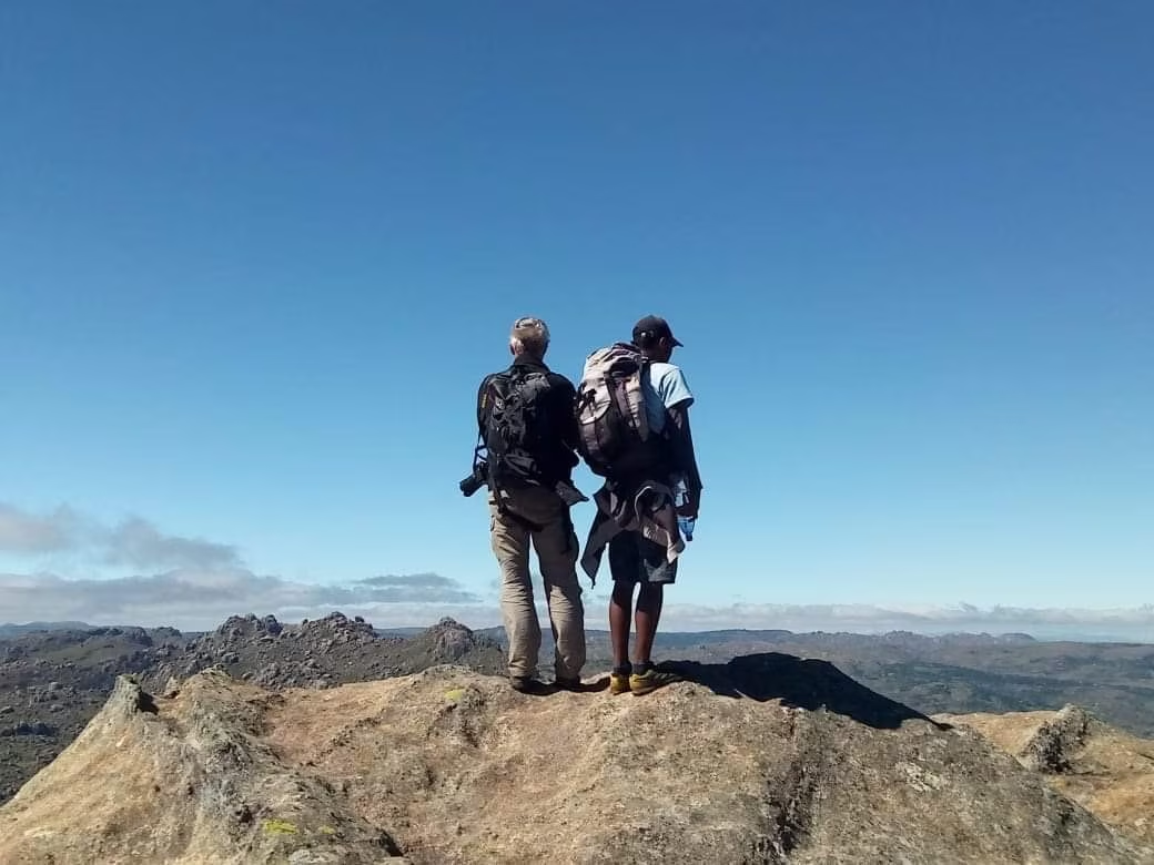
We begin with Vavavato, on the borders of Ankaratra, less than 150 km from Antananarivo. This pink granite massif, which the people of the region also call Mony Mainty, remains off the beaten trekking paths. For five days, we walk around 2,000 meters altitude, between rocky chaos, terraced lakes and hamlets of a mountain people who still live in isolation.
Then we descend westward for the great crossing of North Makay, a vast sandstone plateau carved by water. For six days, our caravan progresses canyon by canyon, often with our feet in the water, between gallery forests, plateaus and sandstone labyrinths, in one of the most preserved massifs on the island.
The journey ends in the limestone of Tsingy de Bemaraha, listed as a UNESCO World Heritage site: the Little Tsingy, the Manambolo gorges by canoe, then the Grand Tsingy and their stone cathedrals.
This journey is undertaken with the people of each massif. Our porters, our cooks and our local guides come from neighboring villages: they carry the caravan, open the trail and set up camp each evening. At the bivouac, we practice precise selective sorting, using color-coded bags, and all waste leaves the massifs with us. Tent pitching, waste management and help in the kitchen, where we train assistants, result in bonuses added to the team's wages. In Tsiazorambo, north of Makay, our driver-guides run a literacy and training program for adults in the village.
High level: 4 to 7 hours of walking per day during the two treks, often off-trail or in water. Nights are cold in Vavavato and heat is intense in the West: good physical condition and a good sleeping bag are essential.
The Makay massif is now placed under the management delegation of Madagascar National Parks, which oversees its protection. Possible entry fees, the amount of which is not yet known, may be added to the journey price.
Season: April to end of October, when Makay canyons are passable and the Tsingy trail is open. An exceptional journey, for 4 to 8 travelers.
The stages of your journey
Highlights
Day-by-day itinerary

Arrival in Antananarivo
According to our flight schedule, we land in Antananarivo in the early afternoon or evening. From the window, the Highlands unfold their red hills, carved with ravines, and every valley floor is occupied by rice paddies.
Our team welcomes us at Ivato international airport and accompanies us to our hotel. The road crosses the outskirts of the city, between rice paddies, brick factories, street markets and brick houses with upper floors, where hand carts, bush taxis and pedestrians share the road.
Antananarivo, which everyone calls Tana, is built on a dozen hills. The upper city, crowned by the Rova, the former palace of the Merina sovereigns, overlooks Lake Anosy and its jacarandas.
If we arrive in the early afternoon, we can take a first walk through the city center, or simply rest. Dinner, on your own, is an opportunity to discover the cuisine of the Highlands: rice, brèdes cooked in broth and zebu in all its forms.
On this first evening, our guide presents us with the itinerary: the granite of the Vavavato, the sandstone of the Makay, then the limestone of the Tsingy of Bemaraha. We check together the equipment for the eleven nights under canvas: a good sleeping bag for the cold nights at altitude, well-worn shoes, sandals for the rivers and a headlamp.

From Antananarivo to Lake Itasy
After breakfast, we leave Antananarivo heading west. The road crosses the rice plains of the capital, then the villages of the Highlands, with their red brick houses and terraced rice fields. Gradually, large volcanic cones appear on the horizon: we are entering Itasy.
Itasy is a cluster of several dozen recent volcanoes on a geological timescale. Their lava flows blocked the valleys and gave birth to Lake Itasy, one of the largest in Madagascar. The volcanic soils are fertile, and crops climb the slopes.
Late morning, we arrive in Ampefy, on the shores of the lake. After lunch, an easy walk along the banks takes us through hamlets of fishermen and farmers: canoes pulled up on the shore, nets drying, rice fields meeting the water's edge. This first walk allows us to find our rhythm.
Late afternoon, the slanting light on the lake and volcanoes is very beautiful. At the hotel, we meet the team that will accompany us during the trek. At dinner, our guide presents the five days ahead in the Vavavato, a granite massif very rarely explored, around 2,000 meters altitude. Most of the baggage will travel with the porters; everyone keeps a small bag for the day.

By the Faratsiho road, start of the trek on the balconies of Ankaratra
We leave Ampefy along one of the most beautiful mountain roads in Madagascar. It rises in switchbacks above Lake Itasy, then winds its way to Faratsiho, a small town nestled in the heart of Ankaratra, on the island's highest plateaus.
At Faratsiho, we meet up with the porters and the cook. The loads are distributed, and we set off on foot. Very quickly, the roads disappear: villages are connected only by trails and cart paths.
We trace our route through an area of high relief, toward the edges of Bongolava. The villagers cultivate potatoes, and their fields cover the slopes up to the ridges. The trek is progressive, without any particular difficulty, and our trek guide, who knows every hamlet, introduces us to the inhabitants we meet.
In late afternoon, we reach the balconies of Ankaratra, a high-altitude prairie where we set up our first camp, at 1,750 meters. The porters pitch the tents, the cook lights the fire, and we watch the sunset over the reliefs of the west. Night falls quickly, the cool air with it, and the sky becomes filled with stars.
At the camp, the team sorts waste into colored bags and carries it back down the mountain at the end of the trek. This is a rule on all our treks, from the first to the last day.
Faratsiho → Balcon de l'Ankaratra

From the balconies of Ankaratra to the granites of Vavavato
Balcon de l'Ankaratra → Ambatobohangy

The granite chaos and the ascent of Vohitany
Ambatobohangy → Volcan Vohitany
Volcan Vohitany → Lac Vohitany
Off the beaten path on the ridges, towards the central valley
Lac Vohitany → Grande vallée
We set off in the freshness of the morning, across the large rocky ridges that dominate the bivouac. We progress off-trail, from slab to slab, towards beautiful peaks from which you can read the structure of the massif: parallel ridges, separated by narrow valleys and basins occupied by lakes.
We walk around 2,000 meters. The air is cool, but the southern sun remains scorching: hat and sunscreen are essential.
At midday, we emerge into the central valley, in the heart of the mountains, where small hamlets are scattered between cultivated land and lakes. The people here almost never descend into the valleys of the Highlands. Keepers of ancient cults, they are known only to a few scholars, astrologers and traditional practitioners. Their settlement predates the Merina expansion, and history pushed them onto these heights, where they have maintained their way of life.
While searching for documentation on these mountains, we found only a simple mention in a French military document from 1914. Our presence remains discreet: we respect the local taboos, which our guide explains to us, and we take time for encounters.
In late afternoon, we set up the bivouac at the foot of the mountains. It is the longest day of the trek, and the one where we truly enter into the intimacy of the Vavavato.

The shepherds, the vabus and the lakes plateau
Grande vallée → Les lacs
The western range of the Vavavato stretches towards the Betafo region. Peaks rise on either side of our route: no mountaineering, but beautiful hikes on granite ridges, with views over the entire massif.
Since entering the mountains, we come across unusual herds. These are vabus, hybrids between zebu and cattle, sturdy like zebus but without a hump, mixed with enormous pigs. The herders navigate by the sound of their flutes, whose melodies rise from rocky chaos and accompany our walk. This is one of the images that travellers remember the longest.
In the afternoon, the terrain becomes gentler. We reach a remarkable region, dotted with a multitude of lakes and almost flat high-altitude meadows, where rocky outcrops remain very much in evidence. All that's missing are a few yaks to feel like we're on the high plateaus of Spiti, at the gates of Tibet.
On a soft meadow, by a lake, we set up our last bivouac in the Vavavato. After five days of walking, the team has become familiar, and we share a festive dinner around the fire. At night, the silence is only disturbed by the wind in the grass.

Staircase lakes to the rice fields of Betafo, then the road to Miandrivazo
Les lacs → Betafo
We reach the southern edge of the Mony Mainty. Through a narrow valley, dotted with stepped lakes, we rapidly lose altitude and leave the granite behind for volcanoes: the scenery changes completely within a few hours.
Around Betafo, the hillsides and valley bottoms are cultivated and developed with extraordinary care. The beauty of the terraced rice paddies is striking in the morning light. From the wild nature of the Vavavato, we transition without interruption to a nature mastered by humans.
We reach Betafo at midday. We have one last picnic with the team, before saying goodbye to the porters and the cook. The bags of waste, sorted throughout the trek, descend with us.
Our vehicles await us for the long descent westward, one of Madagascar's most beautiful roads. The rice paddies and brick houses fade away, the hills become grassy, and the mountains of southern Bongolava appear bare, carved with lavaka, those great red scars opened in the slopes. The heat rises as we lose altitude: after the cold nights of the Vavavato, the change in climate is striking.
In the late afternoon, we reach Miandrivazo, on the Tsiribihina, one of Madagascar's hottest towns. A shower and a real bed await us before the second trek of the journey.
Lunch picnic
Miandrivazo, Tsiazorambo, Manampanda River
We continue on the road to Malaimbandy, along the Mahajilo. The landscape flattens out: we enter the great furrow that separates the crystalline bedrock of the Highlands from the sedimentary plateaus of the West. To the south, a line of bright cliffs bars the horizon: it is the edge of the Makay.
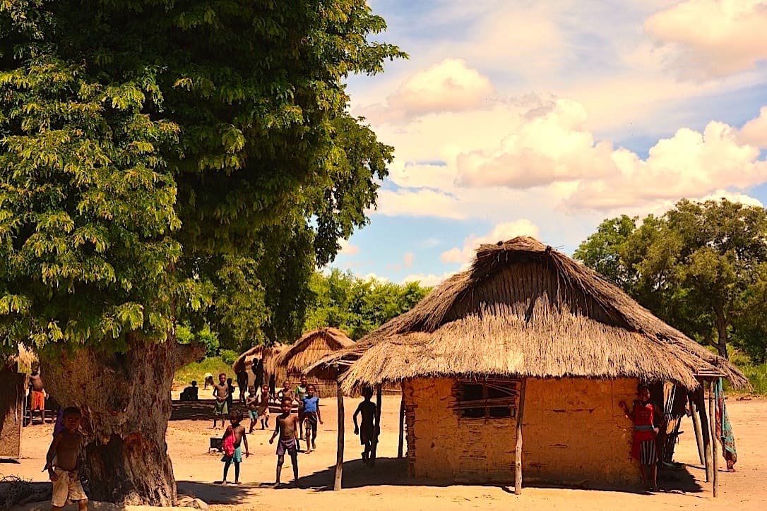
The track crosses a savanna dotted with satrana palms and tamarisk trees, until the village of Tsiazorambo, at the northern base of the massif. Here live the Bara, a people of herders for whom the zebu remains the measure of all wealth. We know this village well: we are building a hut there where our drivers stay during the trek, and our driver-guides run a literacy program for adults there.
It is in the village that our caravan is formed: porters, cook and his assistants, local guide. The Bara porters know every passage through the massif; they carry the equipment, set up camp and watch over the group.
After lunch, we set off on foot. We cross the Manampanda river and reach the first sandstone ridges. The granite of the Highlands gives way to soft sandstone, deposited by ancient rivers more than 200 million years ago, then carved by water. Suddenly, the gaze plunges onto a superb meander of the Manampanda, set within ocher and pink cliffs: our first bivouac in the Makay.
Malaimbandy → Tsiazorambo
Tsiazorambo → Manampanda

Manampanda River, Andasiberivotra, Ankaromokotry Gorge
Andasiberivotra → Ankaromokotry
We leave the bed of the Manampanda at the locality of Andasiberivotra and gain height over the vast tabular reliefs. The Makay is a plateau of crumbly sandstone that extends northward from the Isalo massif. Its successive layers can be read in the cliffs like the pages of a book.
Slight tectonic movements have fractured the plateau, and water has rushed into each fissure. It has carved canyons, isolated towers and domes, sculpted arches and basins. Seen from above, the Makay is a labyrinth: a network of corridors where you need to know the passage.
On the plateau, the savanna of hard grasses is swept by fire, and termite mounds rise their silhouettes among the grasses. The sun beats down hard. We find there the fruit that gave its name to the gorge where we descend late in the morning: Ankaromokotry.
The contrast is striking. In just a few meters, we pass from the harsh light of the plateau to the cool shade of a gorge where clear water flows over a bed of sand, between ferns and palm trees. In the afternoon, we follow it with our feet in the water: in the Makay, water is the road.
The camp is set up on a tongue of white sand. We have time to swim, or to watch the light climb along the cliffs until sunset.

Ankaromokotry Gorge, Ampasimaiky, Andranomanga Canyon
Ankaromokotry → Ampasimaiky
Very quickly, we leave the gorge to climb to higher ground. From here, the logic of the massif becomes apparent: the rivers follow the fractures of the plateau, intersecting at right angles and creating a grid pattern that only hiking allows us to understand. From the eroded domes, our gaze extends far toward the crests of the eastern furrow.
This intricate geography had a major consequence on living things. At the bottom of the canyons, sheltered from fire and humans, animals and plants evolved in isolation, to the point of giving rise to species unique to the massif. Each canyon functions like an island within an island. Lemurs are very present there, but unaccustomed to humans, we catch sight of them more than we observe them.
We reach Ampasimaiky, "the dry sand": water circulates here beneath the sand and reappears further on. On these banks, our local guide teaches us to read animal tracks.
In the afternoon, the route becomes more complex: we must navigate around the plateau's fissures and follow the guide, who reads this terrain like a map. Along a steep path, we descend toward the waters of Andranomanga, at the bottom of a magnificent canyon, which we climb back through a landscape of pools, corridors and natural amphitheaters of rock.
We camp in the gorge, to the sound of water, beneath a sky of rare stellar density.
Ampasimaiky → Andranomanga
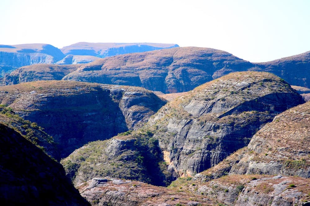
Andranomanga Canyon, pass, Sakapaly Ambony
Andranomanga → Col Andranomanga
We head up the Andranomanga canyon toward its source. The riverbed narrows, and a few passages between the boulders require using our hands: small climbing steps, with no technical difficulty, where mutual assistance naturally develops.
The walls tell the story of the rock: oblique stratification, traces of ancient dunes or channels frozen in sandstone, cornices and overhangs. In this humid gorge, ferns, pandanus and palm trees take advantage of every ledge. The Makay shelters eleven lemur species, over a hundred bird species, reptiles, amphibians and the fossa, which we have little chance of encountering.
Late in the morning, we reach a pass, the watershed line between the Manampanda basin and the Sakapaly basin. It is a key passage of the trek, and the view encompasses both slopes. We take time to read the landscape, map in hand, with the guide.
From the pass, a well-marked trail, used long ago by the dahalos, leads us toward the head of Sakapaly. Black parrots are omnipresent, and raptors soar above the ridges: eleven of the fourteen species of diurnal raptors in Madagascar frequent the massif.
We set up camp on the white sands of Sakapaly Ambony. As night falls, bats emerge from the cliff for their silent rounds above the river.
Col Andranomanga → Sakapaly Ambony
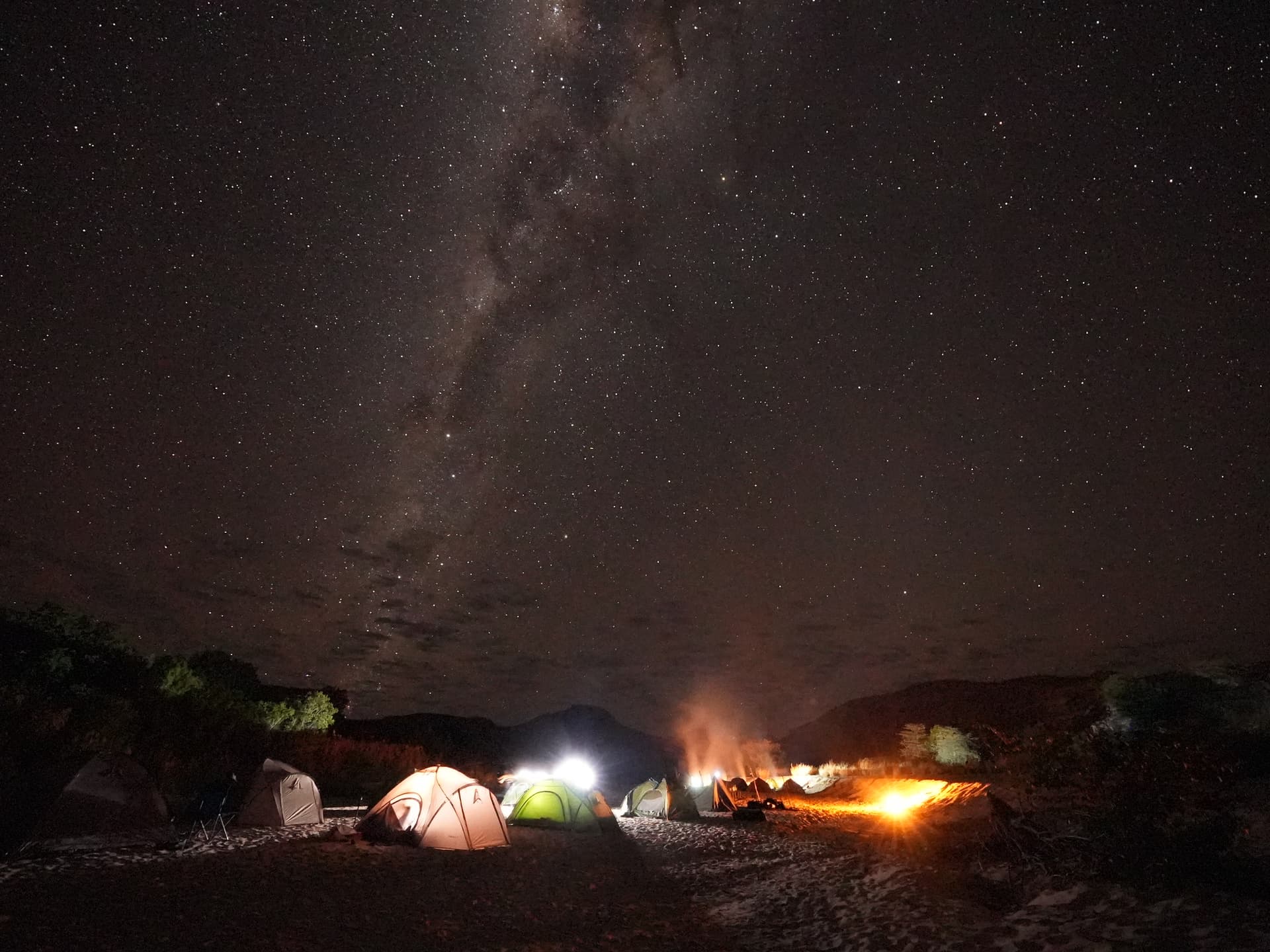
Sakapaly Ambony, Sakapaly canyon and valley
Sakapaly Ambony → Sakapaly
This is one of the most beautiful days of the trek. Through a complex route, we navigate more than we walk between the ridgelines. The plateau is cut into blades, hillocks and corridors, and only a guide who knows the massif knows through which gap to descend toward a magnificent canyon.
We slip through this narrow passage, our feet in crystalline water. The walls draw closer sometimes to the point of touching both banks when stretching our arms. The water has sculpted giant potholes, grooves and overhangs shaped like frozen waves. Iron oxides tint the sandstone red, orange and violet, and the light falling from above changes these colors with each hour.
Then the river becomes calm and the canyon opens onto a completely preserved forest, dominated by tall grey and mauve cliffs: the valley of Sakapaly. Here grows the Ravenela rakatra, a threatened palm tree of which the Makay is home to the last large wild population. It is in this gallery forest that we have the best chance of seeing lemurs, in the early morning or late afternoon.
The bivouac is set up on a white sand beach. The afternoon is a moment of sharing with the team, then we gain height to see the cliffs light up in the setting sun over the valley.

Sakapaly Valley, pandanus gorge, Manampanda River
Sakapaly Ambony → Manampanda
This morning, our caravan makes its way at the foot of the cliffs, then reaches the plateau. The view opens up again over the immensity of the massif: tabular buttes, rounded domes, cracks filled with shadow. Our objective is a narrow gorge, covered with pandanus, palms and ferns, which opens the passage towards the Manampanda basin.
We descend into this gorge with pandanus, once again with our feet in the water, in a lush vegetative environment. Lemurs disappear into the canopy at our approach.
In the river bed, petrified wood bears witness to a fossil forest. These trunks, buried in sediments millions of years ago, have had their matter replaced, molecule by molecule, by silica. They have kept their rings and their bark. We look at them, we photograph them, and we leave them in their place: this heritage must be protected.
Further on, our tributary joins the Manampanda, swollen with all the waters of the canyons, wide, clear and powerful. Birds are numerous along the banks, and the traces on the sand tell of the valley's nocturnal life.
It is a long day, without technical difficulty, at the pace of the caravan. Our last camp is established on a beach by the Manampanda: one last evening around the fire with the entire team.

Makay exit at Tsiazorambo, then the road to Kirindy
Manampanda → Tsiazorambo
For a good hour, we continue to follow the Manampanda in the cool of the morning, then we reach the plateau. From the ridge line, we take one last look toward the heart of the massif. The Makay recedes, and with it the silence of the canyons and the nights on the sand.
We descend toward the bara villages north of the massif. The trails widen, herds of zebu cattle graze on the slopes, and children come to meet us.
At Tsiazorambo, our vehicles are waiting for us: our drivers have been waiting for us at the village throughout the trek. We share a final meal with the team, then comes the time to take leave of the porters, the cook and the local guide. Their wages, the trek bonuses and the work they find with us each season are an important resource for these families. The bags of waste leave the massif with us: nothing remains there.
By the track, we reach Malaimbandy across the savanna, then the western road, toward Mahabo and the Menabe plain. The cliffs of the Makay fade behind us, sakalava villages succeed bara villages, and rice paddies reappear in the irrigated plains.
Before Morondava, we turn north. We stop at Kirindy at the end of the day, which shortens the road the next day to the Tsingy.
Tsiazorambo → Malaimbandy

From Kirindy to Bekopaka, via Belo-sur-Tsiribihina
We leave early, as the Western trail requires time. It heads north through the Menabe plain, between savannas, rice paddies and dry forest. Sakalava villages succeed one another, with their wooden houses and palm leaf roofs, their grain stores on stilts and their herds of zebu.
Menabe is the birthplace of one of the great Sakalava kingdoms, which dominated the west of the island from the 17th to the 19th century. Royalty holds an important place here, and the fitampoha, the bathing of the royal relics, is celebrated every ten years at Belo-sur-Tsiribihina.
We cross the Tsiribihina by ferry, amid pirogues and transport boats, then we stop at Belo, a small trading town on the river bank, for a meal and a look at the activity of the port.
In the afternoon, the trail continues north, long and often bumpy: floodplains, dry forests, rivers to ford. Gradually, a long bar of grey cliffs emerges on the horizon. It is the edge of the Bemaraha limestone plateau, our third massif.
At the end of the day, we cross the Manambolo by ferry to reach Bekopaka, at the foot of the Tsingy, where we settle for three nights. After granite and sandstone, limestone will show us another way for water to sculpt stone: no longer by digging, but by dissolving the rock.

The Small Tsingy and the Manambolo Gorges by Canoe
Bemaraha is a vast limestone plateau, formed at the bottom of a sea, then lifted up and slowly dissolved by rainwater. The result is a forest of stone needles and blades, separated by fissures, canyons and caves. The locals call it tsingy, a word that evokes places where it is impossible to walk barefoot. The national park has been inscribed on UNESCO's World Heritage list since 1990.
This morning, we discover the Little Tsingy, very close to Bekopaka. With a local park guide, we wind our way between the pinnacles, walkways and fissures. The formations are lower than those of the Big Tsingy, but already impressive. In the dry forest, we can observe Decken's sifakas, chameleons and many birds.
After lunch, we board a pirogue on the Manambolo, which enters its gorges. The limestone walls, several tens of meters high, isolate us from the world, and their color shifts from grey to white, then to ochre, with each meander. Caves open at water level, birds nest in the crevices.
The gorges shelter ancient tombs, attributed by tradition to the Vazimba, considered the first inhabitants of the region. These places are sacred, and our pirogue operators scrupulously respect their taboos. We drift downstream in the golden light of late afternoon.

The Great Tsingy of Bemaraha
We set off early by vehicle heading north. The track crosses dry forest for about 17 kilometers until reaching the entrance to the Grands Tsingy. Here, limestone formations reach their full grandeur: veritable stone cathedrals, bristling with sharp needles, separated by chasms several tens of meters deep.
With our local guide, we complete at least two trails during the day. The path alternates between canyons, cave crossings, ladders and suspended walkways over the void. We wear a harness, and progress is made safely, secured on cables.
At the bottom of the chasms, humid forest is maintained sheltered from the sun, with its ferns and lianas. On the ridges, only a few plants resist the heat and dryness. This contrast, over just a few meters, is one of the great surprises of Bemaraha.
From the viewpoints at the summit of the tsingy, the panorama is striking: a sea of gray stone, bristling with points, stretching to the horizon. Lemurs, birds and reptiles are often present, and our guide knows how to spot them.
At the end of the day, we return to Bekopaka. This is our last evening in the massifs: after the granite of Vavavato and the sandstone of Makay, the limestone of Bemaraha closes the series of the three stone worlds of this journey. You need sure footing and must not fear heights, but the delicate passages are well equipped.

From Bekopaka to Morondava
We leave Bekopaka after breakfast. The ferry takes us across the Manambolo one last time, and we take one final look at the grey cliffs of Bemaraha.
The track heads south again. We return to the plains of Menabe, the Sakalava villages, the rivers to cross and the dry forest. The road is long, but it gives us time to observe the country with the perspective gained from our days in the massifs: children waving at cars, ox carts laden with rice and wood, women carrying water on their heads.
At Belo-sur-Tsiribihina, we cross the river by ferry once more and stop for lunch. Then the track continues towards Morondava, across a plain where baobabs become more numerous. Madagascar is home to six endemic species of baobabs, several of which grow in this region. These trees are now threatened by the pressure of cultivation and fires.
In late afternoon, we arrive at Morondava, on the edge of the Mozambique Channel, where fishing pirogues line the beaches. Dinner is an opportunity to celebrate the end of our adventure with our guide and drivers. We reflect on these three weeks: the granites and lakes of Vavavato, the canyons and nights on the sand of Makay, the needles and gorges of Bemaraha.

Morondava, flight to Antananarivo
We take advantage of a last morning in Morondava, on the edge of the Mozambique Channel. Depending on the flight schedule, we can take a walk on the beach, among the fishing pirogues leaving or returning from the sea, visit the market or simply enjoy a moment of calm facing the ocean.
These last hours in the West are an opportunity to reflect on the journey traveled: the volcanoes of Itasy, the granite chaos and lakes of Vavavato, the descent towards Betafo, the canyons of Makay, the long track of Menabe, then the Tsingy and the gorges of Manambolo.
We then head to Morondava airport for the flight to Antananarivo. This domestic flight is not included in the price of the trip: its rates vary greatly, and we book it separately, at the best time. From the window, we fly over the plains of the West, then the Highlands and their rice paddies: in less than an hour, we retrace backwards the path traveled for days on foot and on the track.
Upon arrival, our team welcomes us and accompanies us to our hotel for the first night. The rest of the day is free.
Domestic flights sometimes change schedules, and they are sometimes delayed. This is why we keep an entire day in Antananarivo before the international flight: it allows us to absorb any possible delay without jeopardizing the return.
Free day in Antananarivo
This day is our safety margin before the international flight. If the Morondava flight was delayed, it serves to make up for it. If it took place as planned, it belongs to us, and everyone can use it as they wish.
After three weeks of walking, trekking and camping, a day of calm is not a luxury. We can rest, sort through our photos, prepare our luggage or simply enjoy the coolness of the Highlands after the heat of the West.
For those who still feel like walking, our team can organize an excursion to the Ambohimanga hill, about twenty kilometers to the north, in the Imerina countryside (vehicle and guide at additional cost).
Antananarivo can also be discovered on foot, from hill to hill, from the upper town to the stairs and markets of the Analakely district, where crowds gather in joyful disorder.
At the end of the day, we meet up with our guide for one last moment together. Meals for the day are free, and it's an opportunity to choose one of the capital's good restaurants.
Price per person
Indicative price per person, based on double room. Each trip is customized according to your preferences.
This trip can be tailored to your preferences
This itinerary provides an excellent foundation for discovery, but it can be fully customized. Our local advisors build each trip tailored to your budget, dates and preferences.
Not included
- International flights
- The domestic flight Morondava > Antananarivo on D20 (fluctuating rate, booked separately)
- Day 1 dinner, as well as lunches and dinners for Days 20, 21 and 22
- The activities and vehicles of the free day on D21
- The possible entry fees for the Makay massif, now managed by Madagascar National Parks (amount not yet known)
- The single supplement (individual room and tent, with their porter)
- Drinks, tips and personal expenses
- Insurance (cancellation, repatriation, loss or damage to baggage)
- Visa fees
Included
- The services of an English-speaking guide throughout the entire trip
- Local guides, porters and cooks during treks, with additional porters planned for cold weather
- 4x4 vehicle transfers, four travelers per vehicle, fuel included
- Accommodation in double or twin rooms in Antananarivo, Ampefy, Miandrivazo, Kirindy, Bekopaka and Morondava (or similar according to availability)
- Eleven nights under canvas, camping equipment provided (bring a warm sleeping bag)
- Full board, from breakfast on Day 2 to breakfast on Day 20, then breakfasts on Days 21 and 22
- The pirogue in the Manambolo gorges
- Entrance fees for Tsingy de Bemaraha National Park, including mandatory local guides
Practical Information
Registration is considered firm and final after payment of a deposit of 30% of the total price and acceptance of the specific terms of sale.
The balance must be paid no later than 45 days before the departure date.
See our specific terms of sale for full details.
In the event of cancellation by the traveller, the following fees apply:
More than 60 days before departure: 30% of the total price (deposit retained)
Between 60 and 30 days before departure: 50% of the total price
Less than 30 days before departure: 100% of the total price
We strongly recommend taking out cancellation insurance. See our specific terms of sale for full details.
Your Passport:
Important: your passport must be valid. It must be mandatory and obligatorily valid for 6 months after the end of your stay in Madagascar.
Your travel documents
Your valid passport,
Your international and/or domestic flight tickets,
Your repatriation insurance/first aid expenses contract, -
Your vaccination record, not mandatory,
Your blood group card if possible.
Obtaining a visa to enter Malagasy territory
Upon arrival in the territory:
The visa cost is €35 for a stay of less than 30 days.
It is easily obtained upon your arrival in Malagasy territory.
This applies to all airports in Madagascar that receive international flights.
Upon arrival in the terminal, upon exiting the plane, a corridor for passengers is dedicated to issuing tourist visas.
This procedure is the simplest. We recommend it to you.
From the embassies and consulates of your countries of origin:
For information, download the document explaining the procedure and the constitution of the file for obtaining a visa from the Madagascar embassy.
To participate in our trips, it is strongly recommended to be insured for repatriation assistance and medical expenses abroad.
Your local agency encourages you to familiarize yourself with the specific contract developed with our partner CHAPKA ASSURANCES and AXA ASSISTANCE.
To subscribe to insurance, learn about coverage and rates, follow the link below.
CAP EXPLORER: The comprehensive insurance solution designed to enjoy your trip with peace of mind!
Choose the plan that best suits you:
Explorer'Multirisque
Explorer'Annulation
Explorer'Assistance
Explorer' Complementary Credit Card
Specific to our trips, we strongly recommend subscribing to them.
If you choose to subscribe to one of these plans, the policy detailing all coverage and procedures for claiming any loss are available on the insurer's website.
Your local agency will be aware of it, but only the participant is responsible for complying with the procedures for declaring any loss. The participant must therefore keep this policy with them throughout their trip.
Chapka — Cap Explorer
Our insurance partnerTravel with peace of mind with our partner Chapka. Cancellation, repatriation, medical expenses, baggage… All the coverage for a worry-free trip.
Travel with peace of mind — I'll handle the insuranceFrequently asked questions
A tourist visa is required, issued upon arrival at Ivato Airport (Antananarivo) or online (e-visa). Your passport must be valid for at least 6 months from your date of entry. Before booking your trip, check with Madagascar's consular authorities for the conditions applicable to your nationality, including visa fees and authorized lengths of stay.
Go to the My Trips section to find all your projects.
You can send a message to your host directly from the Tea Lounge.
For a tailor-made quality trip, expect between 160 and 270 euros per day and per person, including accommodation, meals, internal transfers and English-speaking guide. International flights (900-1400 euros return) are additional. Long transfers and domestic flights represent a significant portion of the budget.
Your documents are accessible in the Documents tab of your trip.
Absolutely. We adapt each itinerary to suit your travel profile. For families, we prioritize relaxed pacing, family-friendly accommodations, fun and educational activities, and comfortable private transfers. Our local English-speaking guides know how to captivate children with age-appropriate anecdotes.
It's simple. You exchange with our local team to define your wishes, budget and dates. You receive a detailed itinerary proposal within 48 hours. You adjust every detail together until it's perfect. You confirm and travel with peace of mind. Your local agency remains available 7 days a week throughout your trip.
In case of emergency, contact your local agency immediately.
Payment is generally made in two installments.
Our agency is part of the Nomadays network, registered in France. You benefit from APST (Association Professionnelle de Solidarité du Tourisme) protection, which covers 100% of your funds. Secure payment, repatriation insurance included, and English-speaking assistance 24/7 on the ground throughout your stay.
Let's talk about your next trip to Madagascar
Ambassador of Malagasy fihavanana, based in Antananarivo
For me, traveling to Madagascar is stepping into the spirit of fihavanana: sharing, helping one another, meeting people, and taking time to understand what connects them to their land.
— Noro