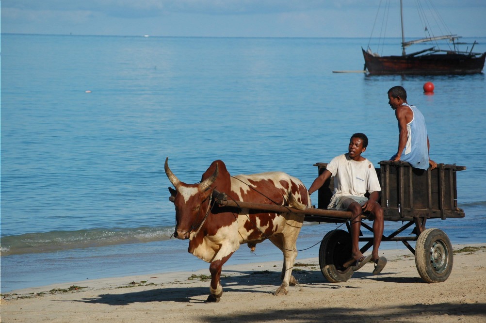
The Pangalanes Canal: a heritage of great value
The Pangalanes Canal: a heritage of great value
A 700 km waterway excavated from 1896 along Madagascar's east coast, the Pangalanes Canal traverses fishing villages, mangroves and forests rich in lemurs.
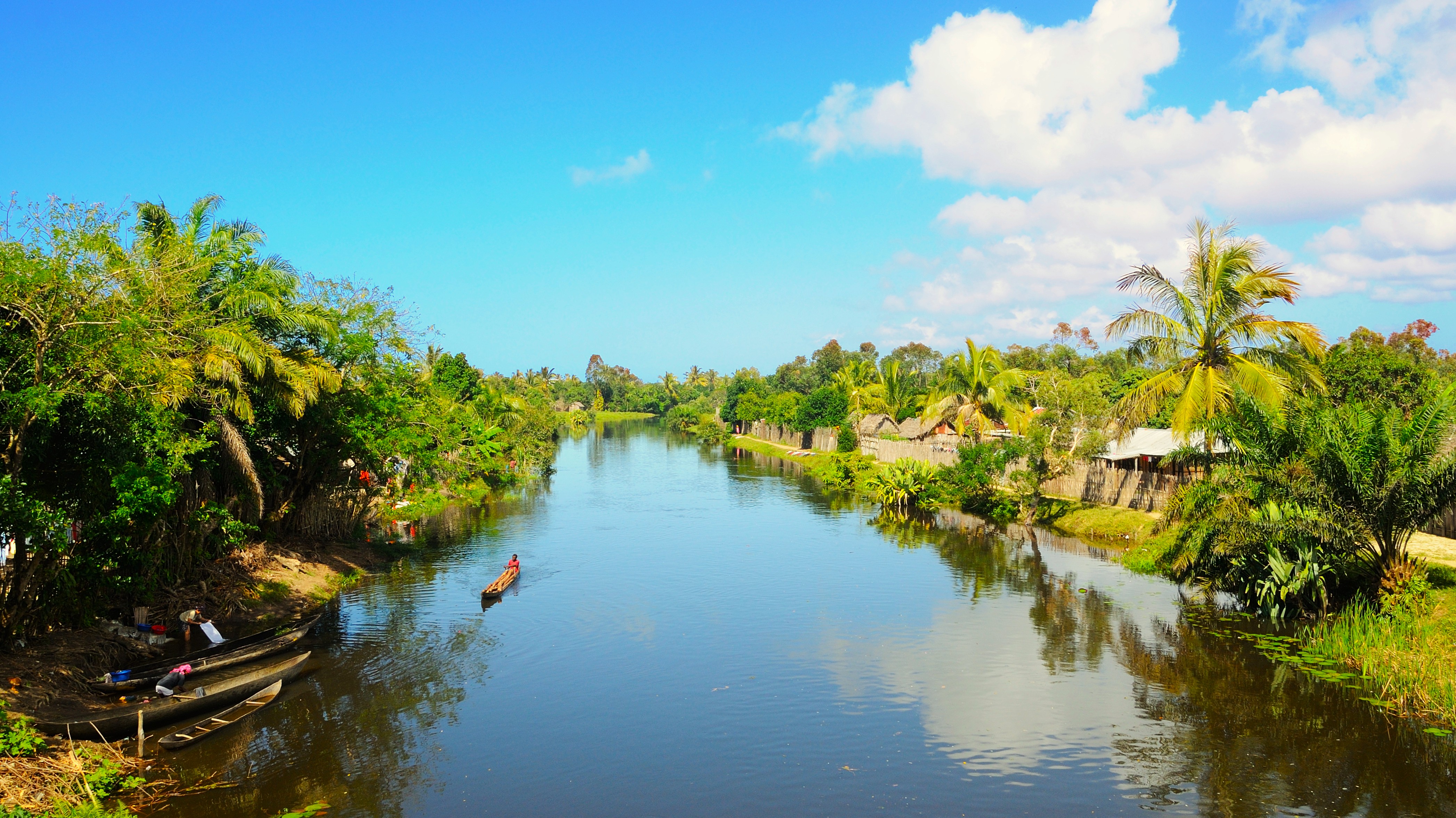
A long ribbon of freshwater running parallel to the Indian Ocean, the Pangalanes Canal links a succession of lakes, lagoons and rivers along Madagascar's east coast. This structure inherited from the colonial period winds through fishing villages, mangroves and coastal forests, offering a mode of transport and discovery distinct from the often degraded terrestrial roads of the region.
Why visit the Pangalanes Canal
- A historic waterway originally stretching nearly 700 km, partially navigable today
- A slow-paced mode of travel that allows observation of daily life in riverside villages
- Coastal biodiversity typical of eastern Madagascar: ravenala, mangroves, tree ferns, lemurs
- An alternative route to the east coast trails, sometimes faster than the road
- Stops at the beach destinations of Ambila-Lemaitso and Mahanoro
A waterway born from colonization
Construction of the Pangalanes Canal was initiated in 1896 under the impetus of General Galliéni, then governor-general of Madagascar. The objective was to facilitate administrative and military control of the eastern coast, while circumventing the obstacles encountered by ships offshore: reefs, violent currents, shipwrecks and sharks.
The idea consisted of connecting the lagoons, lakes and navigable rivers that lined the coast parallel to the shoreline, creating a continuous waterway of approximately 700 km between Foulpointe in the north and Farafangana in the south. For decades, the canal served the transport of goods and passengers.
After independence, lack of maintenance allowed the banks to erode and water lilies and water hyacinths to invade certain sections. By the late 1980s, approximately 400 km of the canal were restored and regained commercial and tourism functions. A broader rehabilitation project was launched with Moroccan agency Marchica MED S.A in partnership with the Malagasy government, whose progress remains to be confirmed with local authorities.
What to see along the canal
Riverside villages
Towns established on the banks originally served as relays for the transport of goods. Today, they remain active: you will encounter pirogues loaded with vegetables, sugar cane, coffee, cloves or pepper. Traditional houses, built on stilts or made of wattle and daub, testify to the vernacular architecture of the east coast. Several artisanal distilleries produce betsabetsa, a local beverage fermented from sugar cane.
Nature and wildlife
Along the banks, the ravenala—or ravenala, the "traveller's palm"—alternates with mangroves and tree ferns. The surrounding forest is home to several species of lemurs, notably sifakas and hapalémurs, observable in certain private reserves bordering the canal.
Remarkable sites
- The beaches of Ambila-Lemaitso, a beach resort near Tamatave
- The site of Mahanoro, an important stop at the centre of the route
- Sakaleona waterfall, in the municipality of Nosy Varika, generally estimated to be around 200 m high (sources vary)
- The sandstone elephant statue weighing approximately 1,000 kg in Ambohitsara, on the Fanantara river, an enigmatic remnant whose origins are debated among historians
Traditional watercraft
Dugout pirogues, bamboo rafts pushed with poles and hollowed tree trunks propelled by paddle still circulate on the canal. Visitors generally travel aboard motorized pirogues or fitted barges.
When to navigate the canal
The dry season, from April to November, remains the most favourable period. Rainfall is less frequent, water levels allow circulation without difficulty and the proliferation of water hyacinths is more contained.
From December to March, the east coast receives heavy precipitation and may be affected by cyclones. Certain sections of the canal then become difficult to navigate, either due to current or because of aquatic plants that obstruct passage.
Practical information
- Cruise duration: from a few hours for a local excursion to several days to cover a significant portion of the route
- Rates: variable depending on the type of vessel, number of passengers and duration; inquire on site or through a local agency
- Accommodation: a few lodges and bungalows exist near Ambila-Lemaitso, Manambato and on the shores of Lake Ampitabe (Akanin'ny Nofy)
- Equipment: sun protection, insect repellent, lightweight covering clothing, shoes that withstand humidity
- Safety: prefer identified operators and verify the condition of life jackets before boarding
How to access the canal
The main embarkation points are located on the east coast, accessible from the capital Antananarivo via national road RN2 to Toamasina (Tamatave), then via secondary routes:
- Tamatave (Toamasina): northern entry point, connected to Antananarivo by RN2 (approximately 350 km)
- Manambato: the most used landing point to reach Lake Ampitabe and Akanin'ny Nofy
- Mahanoro: central stop, accessible by road from Tamatave
- Farafangana: southern end of the historic route, more difficult to access
Most visitors book their cruise from Tamatave or through a local agency that organises transport and boarding.
To combine with your stay
The east coast lends itself to a broader itinerary including national parks and other Malagasy natural sites. Several destinations complement a visit to the canal:
- The Ranomafana national park, humid forest renowned for its lemurs
- The Kirindy forest, on the western slope, to observe a very different dry fauna
- The Cirque rouge, a geological formation near Mahajanga
- The Île de la Vierge, another notable coastal stop
Frequently asked questions
Frequently asked questions
The original route covers approximately 700 km between Foulpointe and Farafangana. Today, approximately 400 km have been restored and remain navigable, primarily in the central-north portion.
From April to November, during the dry season. The cyclone season, from December to March, makes the east coast less practicable and favours the proliferation of water hyacinths.
This depends on the itinerary. A day excursion from Manambato to Akanin'ny Nofy already provides good immersion. To cover a significant portion, allow two to four days by combining navigation and lodge stops.
Yes, several private reserves on the edge of the canal are home to sifakas and hapalémurs, as well as other species. Local guides organise walks in the riparian forest.
The beach destinations of Ambila-Lemaitso and Mahanoro, Sakaleona waterfall near Nosy Varika and the sandstone elephant statue in Ambohitsara on the Fanantara river are among the notable stops.
Plan your trip
The Pangalanes Canal fits naturally into an itinerary combining the east coast, the highlands and the national parks of the south. To build a tailor-made trip that includes this cruise, consult our suggestions for travel to Madagascar.
Interested in this visit?
We can include it in your personalised itinerary.